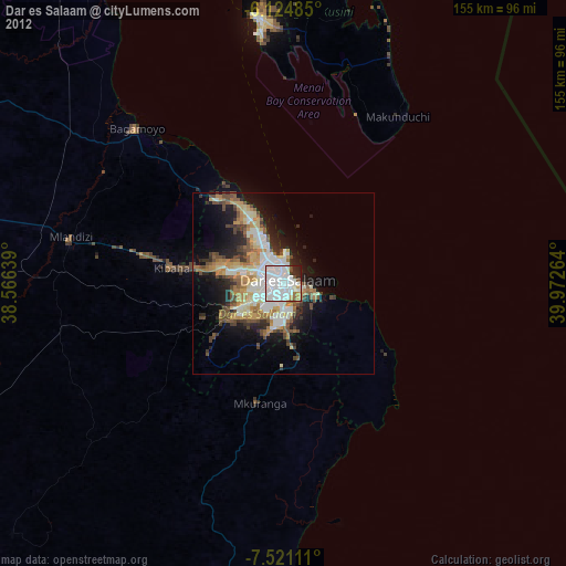
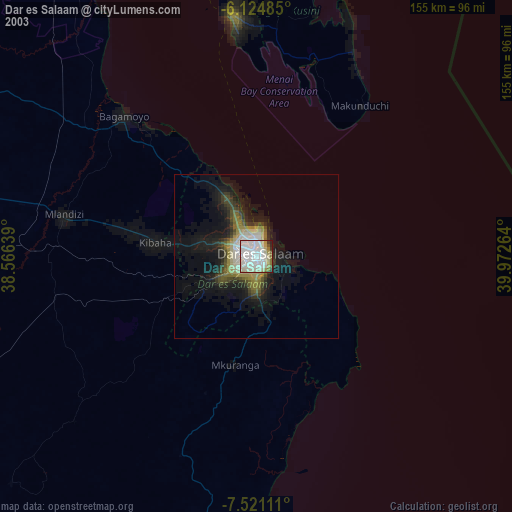
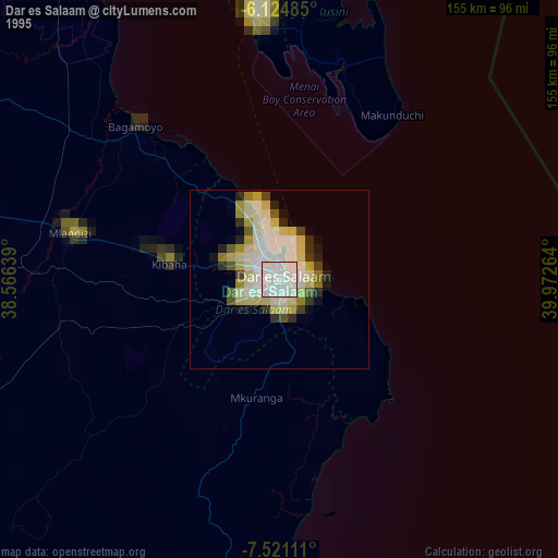
Dar es Salaam night lights from space
Night Light of Dar es Salaam from space (Tanzania) Src. Average luminocity for 10x10km area is 90.987% and for 50x50km: 29.9489%.

Analysis of Dar es Salaam night lights 2016
Square area 10x10 km:
 56.28%
90-99
27.49%80-89
1.08%70-79
2.6%60-69
0.22%50-59
2.6%40-49
2.38%30-39
4.98%20-29
2.38%10-19
0%0-9
0%Square area 50x50 km:
5.97%90-99
7.24%80-89
2.52%70-79
4.64%60-69
4.72%50-59
3.9%40-49
4.72%30-39
2.86%20-29
5.17%10-19
9.16%0-9
49.11%Clear (daylight) street map image can be seen on geolist.org.
Map coordinates:
6° 7' 29.5" South, 38° 33' 59" East
6° 49' 24.6" South, 39° 16' 10.2" East
7° 31' 16" South, 39° 58' 21.5" East
Some cities around Dar es Salaam sort by population:
• Bagamoyo
58.5 km =36.4 mi,  316°
316°
• Mkuranga
33.4 km =20.8 mi,  191°
191°
• Sokoni
53.3 km =33.1 mi,  35°
35°
• Kibaha
39.5 km =24.5 mi,  279°
279°
• Vikindu
20.6 km =12.8 mi,  171°
171°
• Magomeni
3.4 km =2.1 mi, 320°
• Kisarawe
24 km =14.9 mi,  249°
249°
• Mahonda
46.9 km =29.1 mi,  27°
27°
160263 (p: 2,698,652)
Sources (retrieved 2019-11-25):
» NASA, Earths city lights 1995
» NASA city lights 2003
» Earth at Night: Flat Maps 2012, 2016