Babaeski night lights from space
Night Light of Babaeski (Kırklareli) from space (Turkey) Src. Average luminocity for 10x10km area is 20.0833% and for 50x50km: 5.8511%.
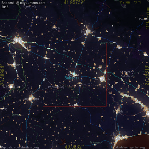

Analysis of Babaeski night lights 2016
Square area 10x10 km:
 3.23%
3.23%90-99
4.93%80-89
0.68%70-79
1.7%60-69
2.89%50-59
1.53%40-49
2.04%30-39
0.17%20-29
1.36%10-19
23.13%0-9
58.33%Square area 50x50 km:
0.45%90-99
0.97%80-89
0.42%70-79
0.74%60-69
0.69%50-59
0.94%40-49
0.98%30-39
0.99%20-29
1.01%10-19
3.52%0-9
89.29%Clear (daylight) street map image can be seen on geolist.org.
Map coordinates:
41° 57' 27.1" North, 26° 23' 23.8" East
41° 25' 57" North, 27° 5' 35" East
40° 54' 11.5" North, 27° 47' 46.3" East
Some cities around Babaeski sort by population:
• Lüleburgaz
22.4 km =13.9 mi,  98°
98°
• Kırklareli
35.4 km =22 mi,  18°
18°
• Uzunköprü
38.5 km =23.9 mi,  241°
241°
• Hayrabolu
24.4 km =15.2 mi,  177°
177°
• Orestiáda, GR
47.6 km =29.6 mi,  279°
279°
• Pınarhisar
41.4 km =25.7 mi,  59°
59°
• Didymóteicho, GR
50.7 km =31.5 mi,  259°
259°
• Havsa
26 km =16.2 mi,  299°
299°
751371 (p: 26,724)
Sources (retrieved 2019-11-25):
» Earth at Night: Flat Maps 2012, 2016