Port el Kantaoui night lights from space
Night Light of Port el Kantaoui (Sūsah) from space (Tunisia) Src. Average luminocity for 10x10km area is 50.7692% and for 50x50km: 14.787%.
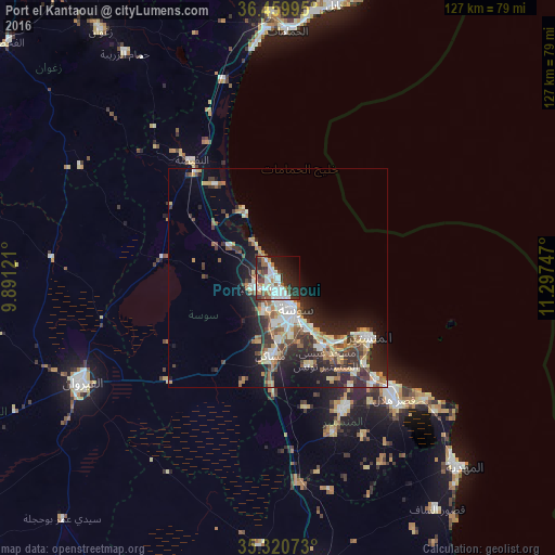
Analysis of Port el Kantaoui night lights 2016
Square area 10x10 km:
 12.64%
90-99
15.2%80-89
1.83%70-79
3.3%60-69
7.88%50-59
3.66%40-49
5.31%30-39
9.71%20-29
16.67%10-19
15.38%0-9
8.42%Square area 50x50 km:
2.32%90-99
2.46%80-89
1.79%70-79
1.41%60-69
2.42%50-59
1.58%40-49
2.18%30-39
2.73%20-29
5.38%10-19
7.81%0-9
69.93%Clear (daylight) street map image can be seen on geolist.org.
Map coordinates:
36° 27' 35.8" North, 9° 53' 28.4" East
35° 53' 32.6" North, 10° 35' 39.6" East
35° 19' 14.6" North, 11° 17' 50.9" East
Some cities around Port el Kantaoui sort by population:
• Sousse
8.4 km =5.2 mi,  152°
152°
• Msaken
18.2 km =11.3 mi,  183°
183°
• Hammam Sousse
3.6 km =2.2 mi,  167°
167°
• Akouda
3.7 km =2.3 mi,  225°
225°
• Ouardenine
21.6 km =13.4 mi,  160°
160°
• Sahline
18.9 km =11.7 mi, 146°
• Sidi Bou Ali
13.1 km =8.1 mi,  303°
303°
• Harqalah
17.1 km =10.6 mi,  333°
333°
6355180 (p: 6,000)
Sources (retrieved 2019-11-25):
» Earth at Night: Flat Maps 2012, 2016