Sahline night lights from space
Night Light of Sahline (Al Munastīr) from space (Tunisia) Src. Average luminocity for 10x10km area is 52.8129% and for 50x50km: 18.9021%.
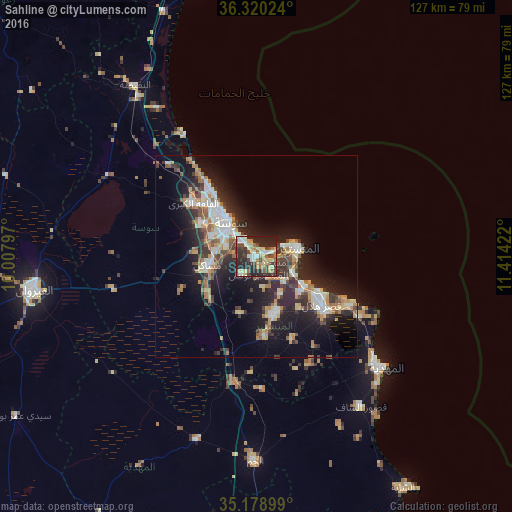
Analysis of Sahline night lights 2016
Square area 10x10 km:
 7.17%
7.17%90-99
7.52%80-89
14.34%70-79
4.9%60-69
6.99%50-59
5.24%40-49
9.97%30-39
9.62%20-29
28.5%10-19
5.77%0-9
0%Square area 50x50 km:
2.79%90-99
2.96%80-89
2.44%70-79
1.96%60-69
3.05%50-59
1.68%40-49
2.55%30-39
3.35%20-29
7.41%10-19
12.76%0-9
59.04%Clear (daylight) street map image can be seen on geolist.org.
Map coordinates:
36° 19' 12.9" North, 10° 0' 28.7" East
35° 45' 6" North, 10° 42' 39.9" East
35° 10' 44.4" North, 11° 24' 51.2" East
Some cities around Sahline sort by population:
• Sousse
10.6 km =6.6 mi,  320°
320°
• Monastir
10.8 km =6.7 mi,  74°
74°
• Msaken
12 km =7.5 mi,  257°
257°
• Skanes
8.8 km =5.5 mi, 66°
• Ouardenine
5.8 km =3.6 mi,  215°
215°
• Banbalah
9.9 km =6.2 mi,  125°
125°
• Ksibet el Mediouni
14 km =8.7 mi,  121°
121°
• Menzel Kamel
14.7 km =9.1 mi,  195°
195°
2473190 (p: 13,806)
Sources (retrieved 2019-11-25):
» Earth at Night: Flat Maps 2012, 2016