São Tomé night lights from space
Night Light of São Tomé (São Tomé Island) from space (Sao Tome and Principe) Src. Average luminocity for 10x10km area is 33.1126% and for 50x50km: 1.9398%.
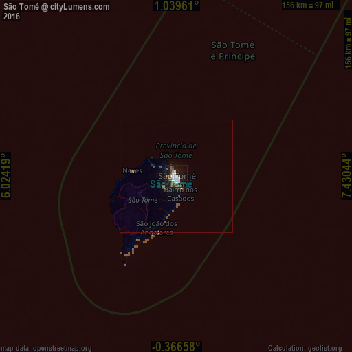
Analysis of São Tomé night lights 2016
Square area 10x10 km:
 7.58%
7.58%90-99
8.01%80-89
0%70-79
0.43%60-69
0.43%50-59
6.28%40-49
12.55%30-39
3.03%20-29
3.25%10-19
34.42%0-9
24.03%Square area 50x50 km:
0.3%90-99
0.32%80-89
0.02%70-79
0.03%60-69
0.02%50-59
0.29%40-49
1.04%30-39
0.22%20-29
0.13%10-19
1.77%0-9
95.85%Clear (daylight) street map image can be seen on geolist.org.
Map coordinates:
1° 2' 22.6" North, 6° 1' 27.1" East
0° 20' 11.5" North, 6° 43' 38.4" East
0° 21' 59.7" South, 7° 25' 49.6" East
Some cities around São Tomé sort by population:
• Libreville, GA
303.2 km =188.4 mi,  88°
88°
• Bata, GQ
378.1 km =234.9 mi,  63°
63°
• Port-Gentil, GA
256.8 km =159.6 mi,  117°
117°
• Lambaréné, GA
407.3 km =253.1 mi,  106°
106°
• Luba, GQ
402 km =249.8 mi,  30°
30°
• Ntoum, GA
337.4 km =209.7 mi, 88°
• San Antonio de Palé, GQ
228.9 km =142.2 mi,  212°
212°
• Santo António
164 km =101.9 mi, 27°
2410763 (p: 53,300)
Sources (retrieved 2019-11-25):
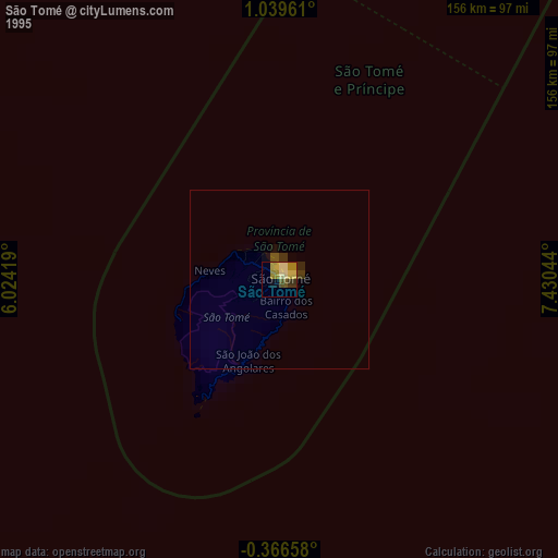
» NASA, Earths city lights 1995
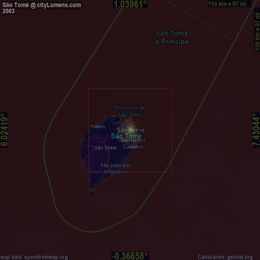
» NASA city lights 2003
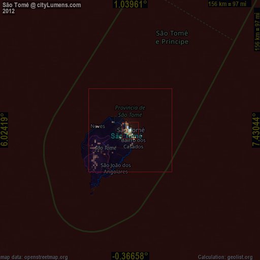
» Earth at Night: Flat Maps 2012, 2016