Port-Gentil night lights from space
Night Light of Port-Gentil (Ogooué-Maritime) from space (Gabon) Src. Average luminocity for 10x10km area is 60.2597% and for 50x50km: 4.1314%.
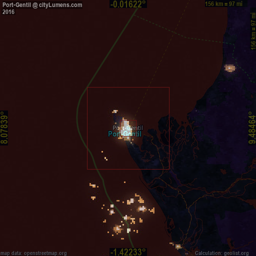
Analysis of Port-Gentil night lights 2016
Square area 10x10 km:
 21.43%
90-99
20.13%80-89
4.76%70-79
0.87%60-69
3.03%50-59
7.36%40-49
1.3%30-39
3.46%20-29
14.94%10-19
20.35%0-9
2.38%Square area 50x50 km:
0.95%90-99
0.98%80-89
0.29%70-79
0.2%60-69
0.35%50-59
0.69%40-49
0.05%30-39
0.21%20-29
1.16%10-19
3.64%0-9
91.48%Clear (daylight) street map image can be seen on geolist.org.
Map coordinates:
0° 0' 58.4" South, 8° 4' 42.2" East
0° 43' 9.6" South, 8° 46' 53.4" East
1° 25' 20.4" South, 9° 29' 4.7" East
Some cities around Port-Gentil sort by population:
• Libreville
144.4 km =89.7 mi,  31°
31°
• São Tomé, ST
256.8 km =159.6 mi,  297°
297°
• Mouila
283.3 km =176 mi,  116°
116°
• Lambaréné
162.2 km =100.8 mi,  89°
89°
• Gamba
253.8 km =157.7 mi,  147°
147°
• Ntoum
164.6 km =102.3 mi,  41°
41°
• Fougamou
207.8 km =129.1 mi,  105°
105°
• Ndjolé
228.6 km =142 mi,  74°
74°
2396518 (p: 109,163)
Sources (retrieved 2019-11-25):
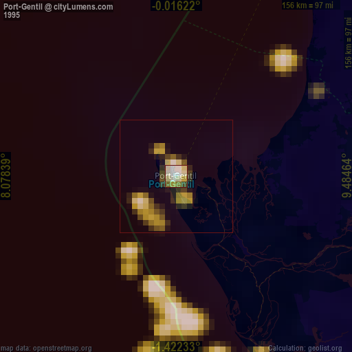
» NASA, Earths city lights 1995
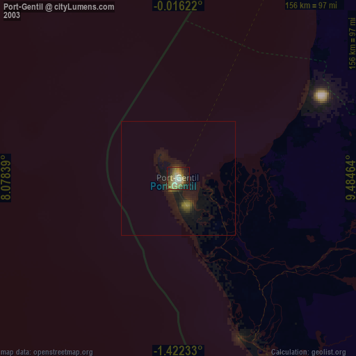
» NASA city lights 2003
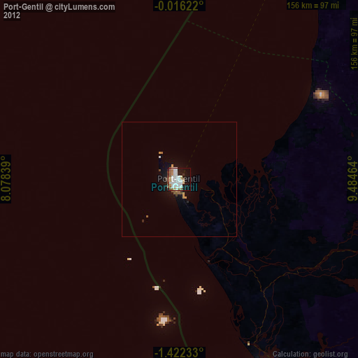
» Earth at Night: Flat Maps 2012, 2016