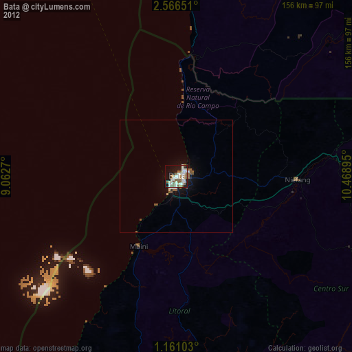
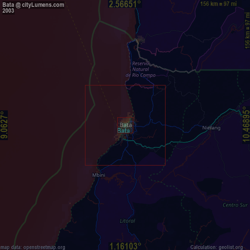
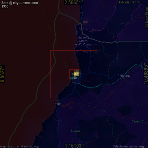
Bata night lights from space
Night Light of Bata (Litoral) from space (Equatorial Guinea) Src. Average luminocity for 10x10km area is 62.3918% and for 50x50km: 4.9417%.
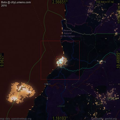
Analysis of Bata night lights 2016
Square area 10x10 km:
 17.75%
90-99
18.4%80-89
6.28%70-79
8.44%60-69
8.66%50-59
5.63%40-49
0.22%30-39
1.95%20-29
16.45%10-19
12.77%0-9
3.46%Square area 50x50 km:
0.8%90-99
0.88%80-89
0.32%70-79
0.36%60-69
1.08%50-59
1.21%40-49
0.31%30-39
0.29%20-29
1.26%10-19
3.82%0-9
89.65%Clear (daylight) street map image can be seen on geolist.org.
Map coordinates:
2° 33' 59.4" North, 9° 3' 45.7" East
1° 51' 50.1" North, 9° 45' 57" East
1° 9' 39.7" North, 10° 28' 8.2" East
Some cities around Bata sort by population:
• Libreville, GA
167.3 km =104 mi,  191°
191°
• Kribi, CM
120.4 km =74.8 mi,  7°
7°
• Aconibe
144.6 km =89.9 mi,  115°
115°
• Añisoc
111.5 km =69.3 mi,  89°
89°
• Akom II, CM
135.5 km =84.2 mi,  41°
41°
• Ntoum, GA
163.8 km =101.8 mi,  180°
180°
• Evinayong
99.4 km =61.8 mi, 118°
• Mikomeseng
98.9 km =61.5 mi,  72°
72°
2310046 (p: 173,046)
Sources (retrieved 2019-11-25):
» NASA, Earths city lights 1995
» NASA city lights 2003
» Earth at Night: Flat Maps 2012, 2016