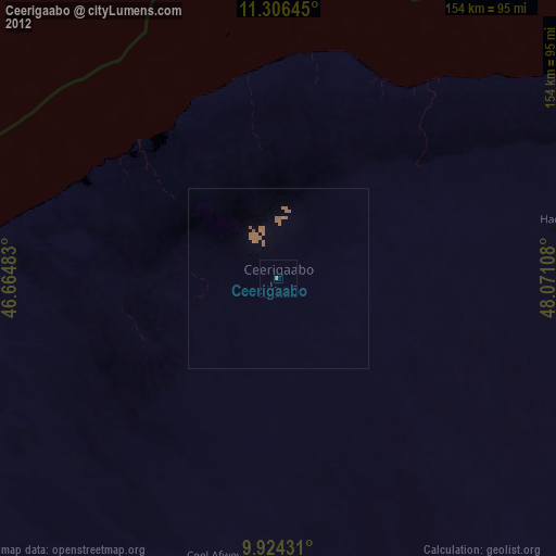
Ceerigaabo night lights from space
Night Light of Ceerigaabo (Sanaag) from space (Somalia) Src. Average luminocity for 10x10km area is 0.4979% and for 50x50km: 0.2594%.
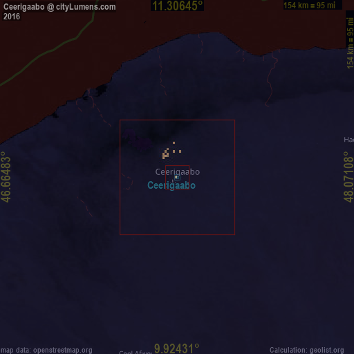
Analysis of Ceerigaabo night lights 2016
Square area 10x10 km:
 0%
0%90-99
0%80-89
0%70-79
0%60-69
0%50-59
0.83%40-49
0%30-39
0%20-29
0%10-19
0%0-9
99.17%Square area 50x50 km:
0%90-99
0%80-89
0%70-79
0%60-69
0.06%50-59
0.34%40-49
0.01%30-39
0%20-29
0%10-19
0%0-9
99.6%Clear (daylight) street map image can be seen on geolist.org.
Map coordinates:
11° 18' 23.2" North, 46° 39' 53.4" East
10° 36' 58.2" North, 47° 22' 4.6" East
9° 55' 27.5" North, 48° 4' 15.9" East
Some cities around Ceerigaabo sort by population:
• Berbera
258 km =160.3 mi,  265°
265°
• Burao
234.8 km =145.9 mi,  238°
238°
• Bosaso
211.5 km =131.4 mi,  69°
69°
• Laascaanood
237.8 km =147.8 mi,  180°
180°
• Garoowe
274.9 km =170.8 mi,  153°
153°
• Qandala
289.4 km =179.8 mi, 70°
• Las Khorey
108.8 km =67.6 mi,  56°
56°
• Oodweyne
285.7 km =177.5 mi, 241°
62691 (p: 33,853)
Sources (retrieved 2019-11-25):
» Earth at Night: Flat Maps 2012, 2016