Al Hilāliyya night lights from space
Night Light of Al Hilāliyya (Al Jazīrah) from space (Sudan) Src. Average luminocity for 10x10km area is 2.9091% and for 50x50km: 1.5502%.
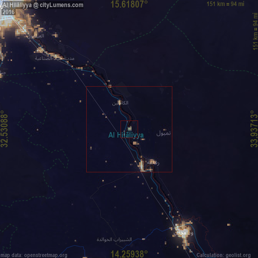
Analysis of Al Hilāliyya night lights 2016
Square area 10x10 km:
 0%
0%90-99
0%80-89
0%70-79
0%60-69
0%50-59
1.65%40-49
1.65%30-39
0.83%20-29
1.65%10-19
0.83%0-9
93.39%Square area 50x50 km:
0%90-99
0.07%80-89
0.03%70-79
0.13%60-69
0.52%50-59
0.38%40-49
0.59%30-39
0.41%20-29
0.37%10-19
0.4%0-9
97.1%Clear (daylight) street map image can be seen on geolist.org.
Map coordinates:
15° 37' 5.1" North, 32° 31' 51.2" East
14° 56' 23.3" North, 33° 14' 2.4" East
14° 15' 33.8" North, 33° 56' 13.7" East
Some cities around Al Hilāliyya sort by population:
• Wad Medani
67.3 km =41.8 mi,  152°
152°
• Al Manāqil
81.5 km =50.6 mi,  198°
198°
• Al Hasaheisa
21.9 km =13.6 mi,  161°
161°
• Kināna
100.7 km =62.6 mi,  183°
183°
• Al Qiţena
93.6 km =58.2 mi,  264°
264°
• Wad Rāwah
26.5 km =16.5 mi,  337°
337°
• Al Kiremit al ‘Arakiyyīn
72.9 km =45.3 mi,  205°
205°
• Al Masallamiyya
42.1 km =26.2 mi, 164°
379406 (p: 17,345)
Sources (retrieved 2019-11-25):
» Earth at Night: Flat Maps 2012, 2016