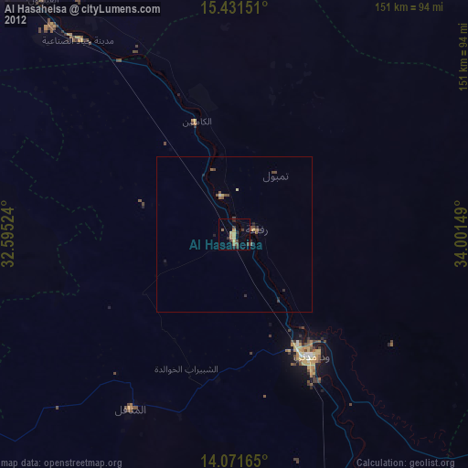
Al Hasaheisa night lights from space
Night Light of Al Hasaheisa (Al Jazīrah) from space (Sudan) Src. Average luminocity for 10x10km area is 16.5041% and for 50x50km: 1.5002%.
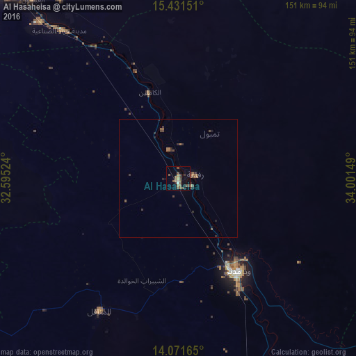
Analysis of Al Hasaheisa night lights 2016
Square area 10x10 km:
 0%
0%90-99
1.65%80-89
0.83%70-79
1.65%60-69
4.34%50-59
4.55%40-49
5.99%30-39
2.27%20-29
1.24%10-19
5.37%0-9
72.11%Square area 50x50 km:
0%90-99
0.07%80-89
0.03%70-79
0.07%60-69
0.5%50-59
0.4%40-49
0.54%30-39
0.36%20-29
0.43%10-19
0.34%0-9
97.26%Clear (daylight) street map image can be seen on geolist.org.
Map coordinates:
15° 25' 53.4" North, 32° 35' 42.9" East
14° 45' 9.5" North, 33° 17' 54.1" East
14° 4' 17.9" North, 34° 0' 5.4" East
Some cities around Al Hasaheisa sort by population:
• Wad Medani
45.8 km =28.5 mi,  148°
148°
• Al Manāqil
65.4 km =40.6 mi,  210°
210°
• Kināna
80.8 km =50.2 mi,  189°
189°
• Al Qiţena
100.9 km =62.7 mi,  277°
277°
• Al Hilāliyya
21.9 km =13.6 mi,  341°
341°
• Wad Rāwah
48.4 km =30.1 mi, 339°
• Al Kiremit al ‘Arakiyyīn
59 km =36.7 mi,  220°
220°
• Al Masallamiyya
20.2 km =12.6 mi,  168°
168°
379427 (p: 28,735)
Sources (retrieved 2019-11-25):
» Earth at Night: Flat Maps 2012, 2016