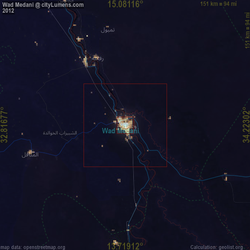
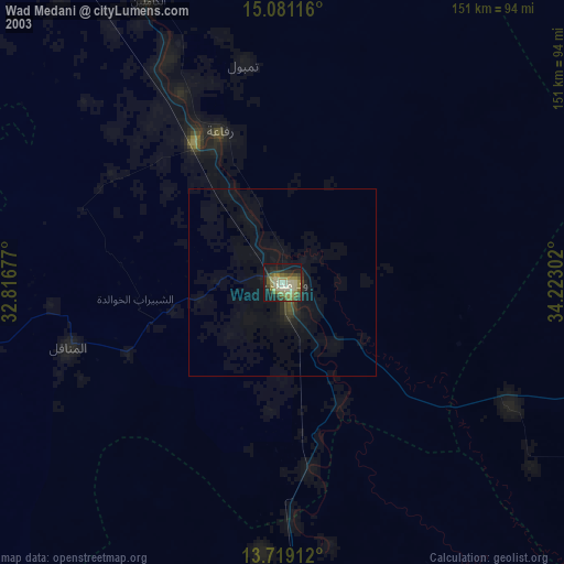
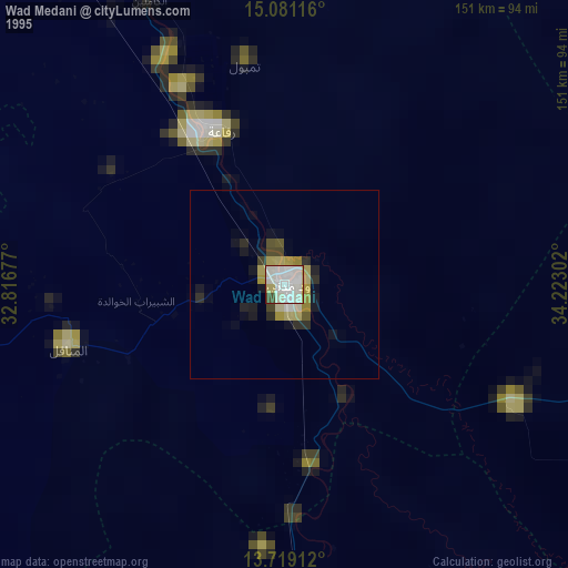
Wad Medani night lights from space
Night Light of Wad Medani (Al Jazīrah) from space (Sudan) Src. Average luminocity for 10x10km area is 55.3095% and for 50x50km: 3.6824%.

Analysis of Wad Medani night lights 2016
Square area 10x10 km:
 8.44%
8.44%90-99
11.69%80-89
6.93%70-79
7.58%60-69
16.45%50-59
5.41%40-49
6.06%30-39
4.98%20-29
15.37%10-19
16.88%0-9
0.22%Square area 50x50 km:
0.33%90-99
0.45%80-89
0.27%70-79
0.43%60-69
0.88%50-59
0.53%40-49
0.74%30-39
0.59%20-29
0.92%10-19
3.05%0-9
91.81%Clear (daylight) street map image can be seen on geolist.org.
Map coordinates:
15° 4' 52.2" North, 32° 49' 0.4" East
14° 24' 4.2" North, 33° 31' 11.6" East
13° 43' 8.8" North, 34° 13' 22.9" East
Some cities around Wad Medani sort by population:
• Sinnar
92.7 km =57.6 mi,  176°
176°
• Al Manāqil
59.7 km =37.1 mi,  253°
253°
• Al Hasaheisa
45.8 km =28.5 mi,  328°
328°
• Kināna
55.3 km =34.4 mi,  222°
222°
• Al Hilāliyya
67.3 km =41.8 mi, 332°
• Wad Rāwah
93.8 km =58.3 mi, 334°
• Al Kiremit al ‘Arakiyyīn
62.3 km =38.7 mi,  264°
264°
• Al Masallamiyya
27.6 km =17.1 mi,  314°
314°
364103 (p: 332,714)
Sources (retrieved 2019-11-25):
» NASA, Earths city lights 1995
» NASA city lights 2003
» Earth at Night: Flat Maps 2012, 2016