Al Masallamiyya night lights from space
Night Light of Al Masallamiyya (Al Jazīrah) from space (Sudan) Src. Average luminocity for 10x10km area is 0.3009% and for 50x50km: 3.9294%.
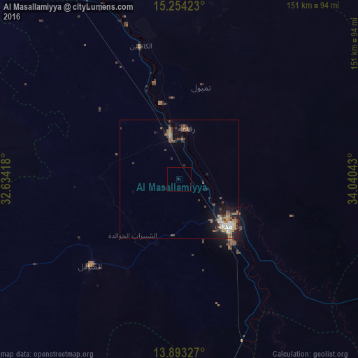
Analysis of Al Masallamiyya night lights 2016
Square area 10x10 km:
 0%
0%90-99
0%80-89
0%70-79
0%60-69
0%50-59
0%40-49
0%30-39
0%20-29
0.87%10-19
0%0-9
99.13%Square area 50x50 km:
0.32%90-99
0.51%80-89
0.29%70-79
0.42%60-69
1.1%50-59
0.63%40-49
0.84%30-39
0.57%20-29
1.02%10-19
2.24%0-9
92.05%Clear (daylight) street map image can be seen on geolist.org.
Map coordinates:
15° 15' 15.2" North, 32° 38' 3" East
14° 34' 29.3" North, 33° 20' 14.3" East
13° 53' 35.8" North, 34° 2' 25.5" East
Some cities around Al Masallamiyya sort by population:
• Wad Medani
27.6 km =17.1 mi,  134°
134°
• Sinnar
114.5 km =71.1 mi,  167°
167°
• Al Hasaheisa
20.2 km =12.6 mi,  348°
348°
• Kināna
62.5 km =38.8 mi,  196°
196°
• Al Qiţena
109.2 km =67.9 mi,  287°
287°
• Al Hilāliyya
42.1 km =26.2 mi,  344°
344°
• Wad Rāwah
68.5 km =42.6 mi, 341°
• Al Kiremit al ‘Arakiyyīn
49.3 km =30.6 mi,  239°
239°
379080 (p: 9,373)
Sources (retrieved 2019-11-25):
» Earth at Night: Flat Maps 2012, 2016