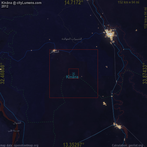
Kināna night lights from space
Night Light of Kināna (Sinnār) from space (Sudan) Src. Average luminocity for 10x10km area is 0% and for 50x50km: 0.2489%.
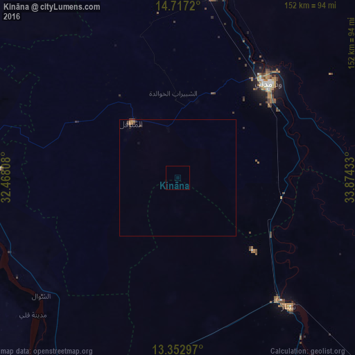
Analysis of Kināna night lights 2016
Square area 10x10 km:
 0%
0%90-99
0%80-89
0%70-79
0%60-69
0%50-59
0%40-49
0%30-39
0%20-29
0%10-19
0%0-9
100%Square area 50x50 km:
0%90-99
0%80-89
0%70-79
0.06%60-69
0.13%50-59
0.02%40-49
0.11%30-39
0.1%20-29
0.01%10-19
0.03%0-9
99.55%Clear (daylight) street map image can be seen on geolist.org.
Map coordinates:
14° 43' 1.9" North, 32° 28' 5.1" East
14° 2' 10" North, 33° 10' 16.3" East
13° 21' 10.7" North, 33° 52' 27.6" East
Some cities around Kināna sort by population:
• Wad Medani
55.3 km =34.4 mi,  42°
42°
• Sinnar
67.3 km =41.8 mi,  140°
140°
• Al Manāqil
30.5 km =19 mi,  319°
319°
• Al Hasaheisa
80.8 km =50.2 mi,  9°
9°
• Al Kawa
79.3 km =49.3 mi,  246°
246°
• Al Kiremit al ‘Arakiyyīn
42.4 km =26.3 mi, 324°
• Al Masallamiyya
62.5 km =38.8 mi,  16°
16°
• Um Jar Al Gharbiyya
86.4 km =53.7 mi, 252°
372386 (p: 26,233)
Sources (retrieved 2019-11-25):
» Earth at Night: Flat Maps 2012, 2016