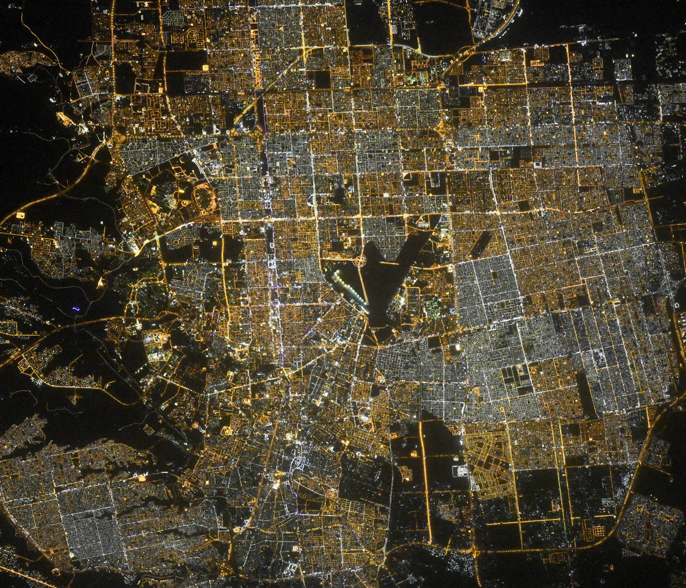
Riyadh night lights from space
Night Light of Riyadh (Ar RiyńĀŠłĎ) from space (Saudi Arabia) Src. Average luminocity for 10x10km area is 100% and for 50x50km: 86.6927%.
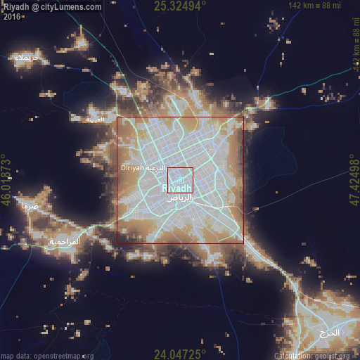
Analysis of Riyadh night lights 2016
Square area 10x10 km:
 100%
100%90-99
0%80-89
0%70-79
0%60-69
0%50-59
0%40-49
0%30-39
0%20-29
0%10-19
0%0-9
0%Square area 50x50 km:
40.76%90-99
23.48%80-89
5.31%70-79
9.07%60-69
12.34%50-59
4.69%40-49
2.4%30-39
1.07%20-29
0.68%10-19
0.21%0-9
0%Clear (daylight) street map image can be seen on geolist.org.
Map coordinates:
25° 19' 29.8" North, 46° 1' 7.4" East
24° 41' 15.8" North, 46° 43' 18.7" East
24° 2' 50.1" North, 47° 25' 29.9" East
Fantastic image of Riyadh from space taken by astronauts [src2], but I don't have information about it's orientation, scale or angle. If necessary, it was rotated manually, so North points approximately to upper direction. Click to zoom in:
Some cities around Riyadh sort by population:
• Al Kharj
85.7 km =53.3 mi,  133°
133°
• Ad DawńĀdimńę
236.4 km =146.9 mi,  265°
265°
• Az Zulfńę
262.1 km =162.9 mi,  313°
313°
• Ad Dilam
89.4 km =55.6 mi,  150°
150°
• SńĀjir
220.9 km =137.3 mi,  284°
284°
• Al ArŇ£ńĀwńęyah
244.4 km =151.9 mi,  325°
325°
• MarńĀt
134.4 km =83.5 mi,  288°
288°
• Tumayr
141.9 km =88.2 mi,  322°
322°
108410 (p: 4,205,961)
Sources (retrieved 2019-11-25):
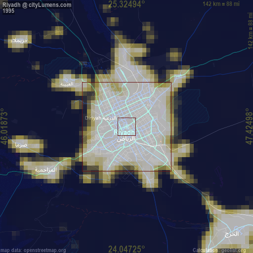
» NASA, Earths city lights 1995
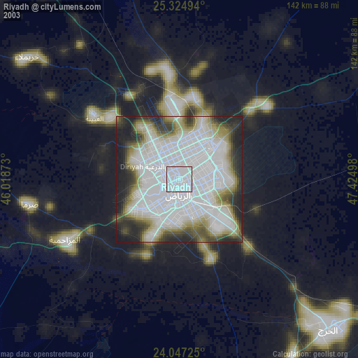
» NASA city lights 2003
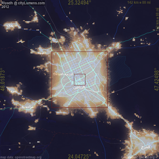
» Earth at Night: Flat Maps 2012, 2016
Src.2: picture by Oleg Kononenko,†Roscosmos, retrieved 2019-11-29