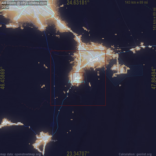
Ad Dilam night lights from space
Night Light of Ad Dilam (Ar Riyāḑ) from space (Saudi Arabia) Src. Average luminocity for 10x10km area is 78.0417% and for 50x50km: 25.0399%.
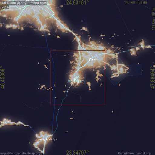
Analysis of Ad Dilam night lights 2016
Square area 10x10 km:
 18.75%
90-99
31.44%80-89
6.44%70-79
2.46%60-69
19.7%50-59
6.63%40-49
6.63%30-39
4.92%20-29
2.27%10-19
0.76%0-9
0%Square area 50x50 km:
4.19%90-99
7.43%80-89
2.86%70-79
3.08%60-69
5.21%50-59
2.53%40-49
2.12%30-39
2.47%20-29
3.77%10-19
6.55%0-9
59.77%Clear (daylight) street map image can be seen on geolist.org.
Map coordinates:
24° 37' 54.5" North, 46° 27' 31.3" East
23° 59' 27.7" North, 47° 9' 42.5" East
23° 20' 49.5" North, 47° 51' 53.8" East
Some cities around Ad Dilam sort by population:
• Riyadh
89.4 km =55.6 mi,  330°
330°
• Al Kharj
25.3 km =15.7 mi,  43°
43°
• Al Hufūf
288.8 km =179.5 mi,  58°
58°
• Al Mubarraz
291.5 km =181.1 mi, 57°
• Ad Dawādimī
286.6 km =178.1 mi,  281°
281°
• Sājir
291 km =180.8 mi,  297°
297°
• Marāt
210 km =130.5 mi, 304°
• Tumayr
230.8 km =143.4 mi, 325°
110314 (p: 35,371)
Sources (retrieved 2019-11-25):
» Earth at Night: Flat Maps 2012, 2016