Az Zulfī night lights from space
Night Light of Az Zulfī (Ar Riyāḑ) from space (Saudi Arabia) Src. Average luminocity for 10x10km area is 91.3849% and for 50x50km: 10.307%.
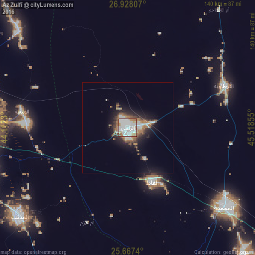
Analysis of Az Zulfī night lights 2016
Square area 10x10 km:
 46.03%
90-99
28.57%80-89
4.96%70-79
4.37%60-69
13.49%50-59
1.39%40-49
1.19%30-39
0%20-29
0%10-19
0%0-9
0%Square area 50x50 km:
2.47%90-99
2%80-89
0.47%70-79
0.67%60-69
2.35%50-59
0.91%40-49
0.94%30-39
1.48%20-29
2.69%10-19
5.84%0-9
80.19%Clear (daylight) street map image can be seen on geolist.org.
Map coordinates:
26° 55' 41.1" North, 44° 6' 44.3" East
26° 17' 58" North, 44° 48' 55.5" East
25° 40' 2.6" North, 45° 31' 6.8" East
Some cities around Az Zulfī sort by population:
• Buraydah
83.8 km =52.1 mi,  272°
272°
• Ar Rass
140 km =87 mi,  250°
250°
• Al Mithnab
76.8 km =47.7 mi,  230°
230°
• Al Bukayrīyah
116.8 km =72.6 mi,  261°
261°
• Tanūmah
111.9 km =69.5 mi,  322°
322°
• Sājir
126.1 km =78.4 mi,  189°
189°
• Al Arţāwīyah
57.7 km =35.9 mi,  66°
66°
• Tumayr
124.4 km =77.3 mi,  122°
122°
107781 (p: 53,144)
Sources (retrieved 2019-11-25):
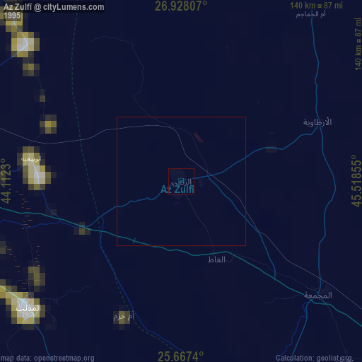
» NASA, Earths city lights 1995
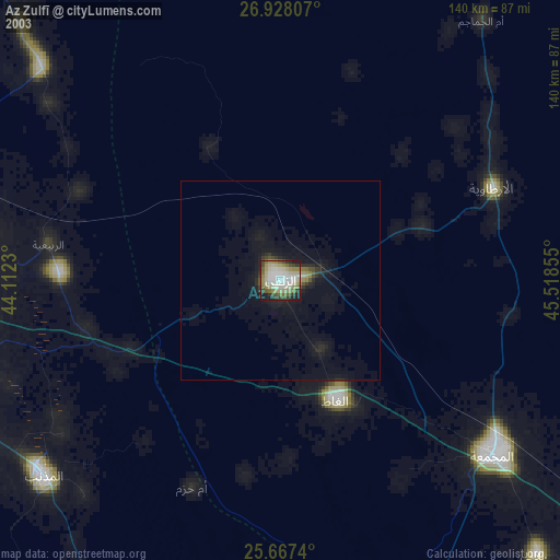
» NASA city lights 2003
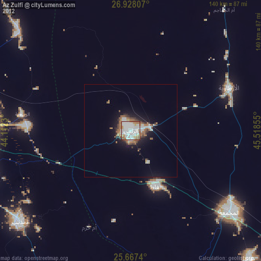
» Earth at Night: Flat Maps 2012, 2016