Al Kharj night lights from space
Night Light of Al Kharj (Ar Riyāḑ) from space (Saudi Arabia) Src. Average luminocity for 10x10km area is 95.3864% and for 50x50km: 41.2876%.
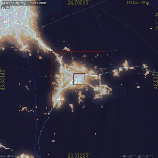
Analysis of Al Kharj night lights 2016
Square area 10x10 km:
 43.37%
90-99
40.15%80-89
7.58%70-79
6.63%60-69
2.27%50-59
0%40-49
0%30-39
0%20-29
0%10-19
0%0-9
0%Square area 50x50 km:
5.05%90-99
11.28%80-89
5.05%70-79
4.84%60-69
10.09%50-59
5.09%40-49
4.08%30-39
5.39%20-29
8.24%10-19
13.17%0-9
27.72%Clear (daylight) street map image can be seen on geolist.org.
Map coordinates:
24° 47' 43.3" North, 46° 37' 53.2" East
24° 9' 19.5" North, 47° 20' 4.5" East
23° 30' 44.1" North, 48° 2' 15.7" East
Some cities around Al Kharj sort by population:
• Riyadh
85.7 km =53.3 mi,  313°
313°
• Al Hufūf
264.2 km =164.2 mi,  59°
59°
• Al Mubarraz
266.9 km =165.8 mi, 58°
• Ad Dilam
25.3 km =15.7 mi,  223°
223°
• Al Jubayl
271.6 km =168.8 mi, 59°
• Marāt
215.3 km =133.8 mi,  298°
298°
• Tumayr
226.9 km =141 mi,  319°
319°
• Al Muţayrifī
268.3 km =166.7 mi, 56°
109353 (p: 425,300)
Sources (retrieved 2019-11-25):
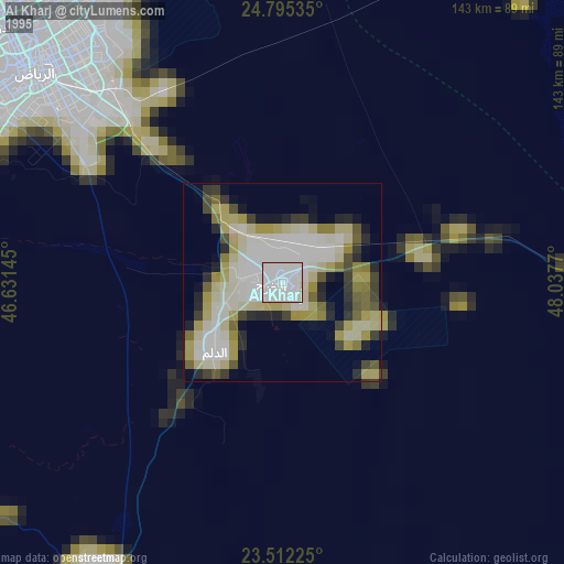
» NASA, Earths city lights 1995
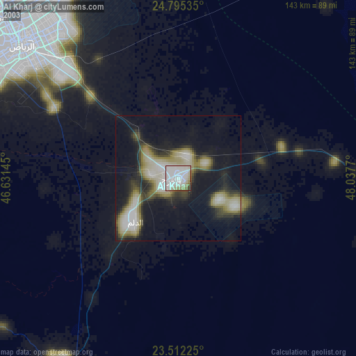
» NASA city lights 2003
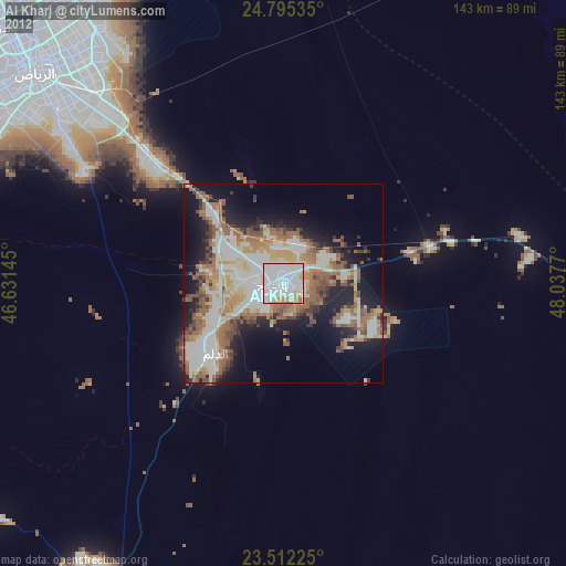
» Earth at Night: Flat Maps 2012, 2016