Sājir night lights from space
Night Light of Sājir (Ar Riyāḑ) from space (Saudi Arabia) Src. Average luminocity for 10x10km area is 53.4206% and for 50x50km: 6.4332%.
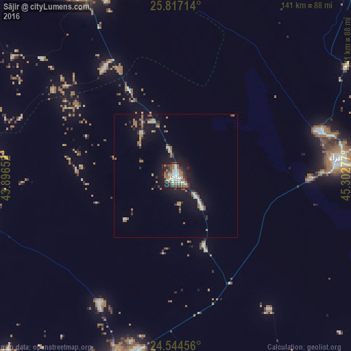
Analysis of Sājir night lights 2016
Square area 10x10 km:
 10.52%
90-99
13.29%80-89
0%70-79
2.78%60-69
19.64%50-59
7.14%40-49
5.16%30-39
11.9%20-29
10.52%10-19
18.45%0-9
0.6%Square area 50x50 km:
0.67%90-99
0.99%80-89
0.3%70-79
0.33%60-69
2.05%50-59
0.84%40-49
0.56%30-39
1.1%20-29
1.07%10-19
6.29%0-9
85.81%Clear (daylight) street map image can be seen on geolist.org.
Map coordinates:
25° 49' 1.7" North, 43° 53' 47.5" East
25° 10' 57" North, 44° 35' 58.7" East
24° 32' 40.4" North, 45° 18' 10" East
Some cities around Sājir sort by population:
• Buraydah
141.7 km =88 mi,  333°
333°
• Ar Rass
134.4 km =83.5 mi,  304°
304°
• Al Mithnab
84.3 km =52.4 mi, 333°
• Ad Dawādimī
77.9 km =48.4 mi,  195°
195°
• Az Zulfī
126.1 km =78.4 mi,  9°
9°
• Al Bukayrīyah
142.2 km =88.4 mi,  318°
318°
• Marāt
87.3 km =54.2 mi,  98°
98°
• Tumayr
139.9 km =86.9 mi,  65°
65°
108121 (p: 11,717)
Sources (retrieved 2019-11-25):
» Earth at Night: Flat Maps 2012, 2016