Óbidos night lights from space
Night Light of Óbidos (Leiria) from space (Portugal) Src. Average luminocity for 10x10km area is 33.3248% and for 50x50km: 20.6248%.
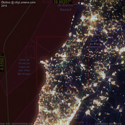
Analysis of Óbidos night lights 2016
Square area 10x10 km:
 2.21%
2.21%90-99
2.04%80-89
3.91%70-79
6.46%60-69
5.1%50-59
4.25%40-49
3.23%30-39
7.82%20-29
21.26%10-19
42.01%0-9
1.7%Square area 50x50 km:
1.23%90-99
2.18%80-89
2.09%70-79
2.2%60-69
3.32%50-59
3.51%40-49
2.73%30-39
4.59%20-29
9.51%10-19
23.56%0-9
45.08%Clear (daylight) street map image can be seen on geolist.org.
Map coordinates:
39° 54' 7.5" North, 9° 51' 35.4" West
39° 21' 38" North, 9° 9' 24.1" West
38° 48' 53.3" North, 8° 27' 12.9" West
Some cities around Óbidos sort by population:
• Caldas da Rainha
5 km =3.1 mi,  18°
18°
• Peniche
19.3 km =12 mi,  268°
268°
• Rio Maior
18.9 km =11.7 mi,  97°
97°
• Lourinhã
18.8 km =11.7 mi,  225°
225°
• Benedita
17.6 km =10.9 mi,  66°
66°
• Atouguia da Baleia
14.8 km =9.2 mi,  260°
260°
• A dos Cunhados
26.1 km =16.2 mi,  207°
207°
• Bombarral
10.4 km =6.5 mi,  180°
180°
2265485 (p: 11,187)
Sources (retrieved 2019-11-25):
» Earth at Night: Flat Maps 2012, 2016