Baguim do Monte night lights from space
Night Light of Baguim do Monte (Porto) from space (Portugal) Src. Average luminocity for 10x10km area is 92.2792% and for 50x50km: 56.0483%.
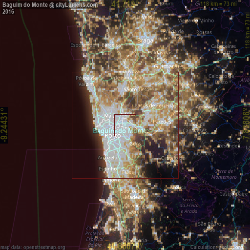
Analysis of Baguim do Monte night lights 2016
Square area 10x10 km:
 65.1%
65.1%90-99
15.58%80-89
1.62%70-79
5.36%60-69
4.06%50-59
4.38%40-49
3.9%30-39
0%20-29
0%10-19
0%0-9
0%Square area 50x50 km:
14.98%90-99
12.38%80-89
6.71%70-79
8.95%60-69
10.02%50-59
6.79%40-49
5.61%30-39
5.01%20-29
5.16%10-19
6.21%0-9
18.18%Clear (daylight) street map image can be seen on geolist.org.
Map coordinates:
41° 43' 8.4" North, 9° 14' 39.5" West
41° 11' 31.3" North, 8° 32' 28.2" West
40° 39' 38.8" North, 7° 50' 17" West
Some cities around Baguim do Monte sort by population:
• Rio Tinto
2.1 km =1.3 mi,  226°
226°
• Ermesinde
2.9 km =1.8 mi,  339°
339°
• Gondomar
5.3 km =3.3 mi,  171°
171°
• Águas Santas
3.5 km =2.2 mi,  304°
304°
• Fânzeres
2.9 km =1.8 mi,  160°
160°
• Valongo
3.6 km =2.2 mi,  95°
95°
• Alfena
5.2 km =3.2 mi,  15°
15°
• Pedrouços
3.8 km =2.4 mi,  264°
264°
2742506 (p: 15,850)
Sources (retrieved 2019-11-25):
» Earth at Night: Flat Maps 2012, 2016