Fânzeres night lights from space
Night Light of Fânzeres (Porto) from space (Portugal) Src. Average luminocity for 10x10km area is 89.1477% and for 50x50km: 55.1283%.
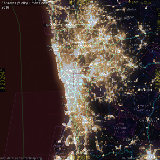
Analysis of Fânzeres night lights 2016
Square area 10x10 km:
 58.28%
90-99
15.1%80-89
3.73%70-79
4.38%60-69
5.52%50-59
6.33%40-49
4.22%30-39
2.44%20-29
0%10-19
0%0-9
0%Square area 50x50 km:
14.74%90-99
11.94%80-89
6.58%70-79
8.6%60-69
9.86%50-59
6.71%40-49
5.57%30-39
5.12%20-29
5.57%10-19
6.57%0-9
18.74%Clear (daylight) street map image can be seen on geolist.org.
Map coordinates:
41° 41' 40.9" North, 9° 13' 58.6" West
41° 10' 3.1" North, 8° 31' 47.3" West
40° 38' 10" North, 7° 49' 36.1" West
Some cities around Fânzeres sort by population:
• Rio Tinto
2.8 km =1.7 mi,  296°
296°
• Gondomar
2.6 km =1.6 mi,  184°
184°
• Valongo
3.5 km =2.2 mi,  47°
47°
• São Pedro da Cova
3.7 km =2.3 mi,  137°
137°
• Baguim do Monte
2.9 km =1.8 mi,  340°
340°
• Valbom
5 km =3.1 mi,  212°
212°
• Pedrouços
5.3 km =3.3 mi, 296°
• Campo
5.8 km =3.6 mi,  70°
70°
2739756 (p: 23,916)
Sources (retrieved 2019-11-25):
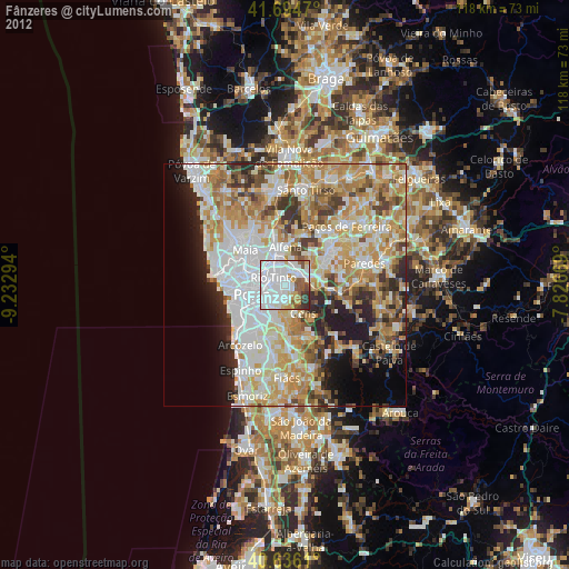
» Earth at Night: Flat Maps 2012, 2016