Witnica night lights from space
Night Light of Witnica (Lubusz) from space (Poland) Src. Average luminocity for 10x10km area is 3.5886% and for 50x50km: 3.0103%.
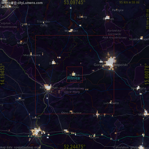
Analysis of Witnica night lights 2016
Square area 10x10 km:
 0.26%
0.26%90-99
0.26%80-89
1.72%70-79
0.4%60-69
0.53%50-59
0%40-49
0.53%30-39
0%20-29
0%10-19
1.06%0-9
95.24%Square area 50x50 km:
0.69%90-99
0.64%80-89
0.21%70-79
0.21%60-69
0.29%50-59
0.29%40-49
0.31%30-39
0.18%20-29
0.75%10-19
1.85%0-9
94.58%Clear (daylight) street map image can be seen on geolist.org.
Map coordinates:
53° 5' 50.8" North, 14° 11' 40.3" East
52° 40' 23.4" North, 14° 53' 51.5" East
52° 14' 41.1" North, 15° 36' 2.8" East
Some cities around Witnica sort by population:
• Gorzów Wielkopolski
23.4 km =14.5 mi,  72°
72°
• Kostrzyn nad Odrą
19.3 km =12 mi,  240°
240°
• Barlinek
41.7 km =25.9 mi,  31°
31°
• Dębno
15.3 km =9.5 mi,  298°
298°
• Myślibórz
27.9 km =17.3 mi,  355°
355°
• Sulęcin
29.4 km =18.3 mi,  149°
149°
• Rzepin
36.6 km =22.7 mi,  186°
186°
• Seelow, DE
38.2 km =23.7 mi,  246°
246°
3081818 (p: 6,821)
Sources (retrieved 2019-11-25):
» Earth at Night: Flat Maps 2012, 2016