Sulejów night lights from space
Night Light of Sulejów (Łódź Voivodeship) from space (Poland) Src. Average luminocity for 10x10km area is 0.7297% and for 50x50km: 3.6608%.
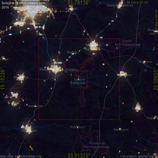
Analysis of Sulejów night lights 2016
Square area 10x10 km:
 0%
0%90-99
0%80-89
0%70-79
0%60-69
0%50-59
0.56%40-49
0.28%30-39
0%20-29
0.56%10-19
0.56%0-9
98.04%Square area 50x50 km:
0.61%90-99
0.66%80-89
0.44%70-79
0.35%60-69
0.28%50-59
0.49%40-49
0.24%30-39
0.32%20-29
0.77%10-19
3.62%0-9
92.23%Clear (daylight) street map image can be seen on geolist.org.
Map coordinates:
51° 47' 28.9" North, 19° 10' 56.1" East
51° 21' 15.7" North, 19° 53' 7.4" East
50° 54' 47.3" North, 20° 35' 18.6" East
Some cities around Sulejów sort by population:
• Piotrków Trybunalski
13.9 km =8.6 mi,  294°
294°
• Tomaszów Mazowiecki
21.4 km =13.3 mi,  23°
23°
• Bełchatów
36.7 km =22.8 mi,  272°
272°
• Radomsko
44.3 km =27.5 mi,  223°
223°
• Opoczno
27.4 km =17 mi,  85°
85°
• Końskie
40.5 km =25.2 mi,  116°
116°
• Koluszki
43 km =26.7 mi,  353°
353°
• Tuszyn
37.5 km =23.3 mi,  319°
319°
3084230 (p: 6,332)
Sources (retrieved 2019-11-25):
» Earth at Night: Flat Maps 2012, 2016