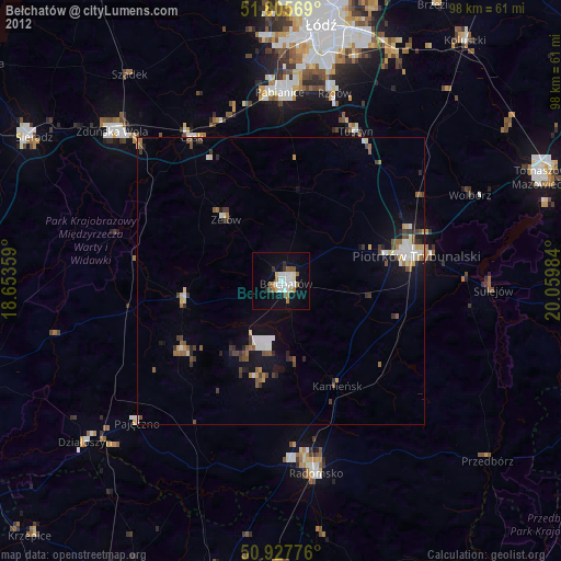
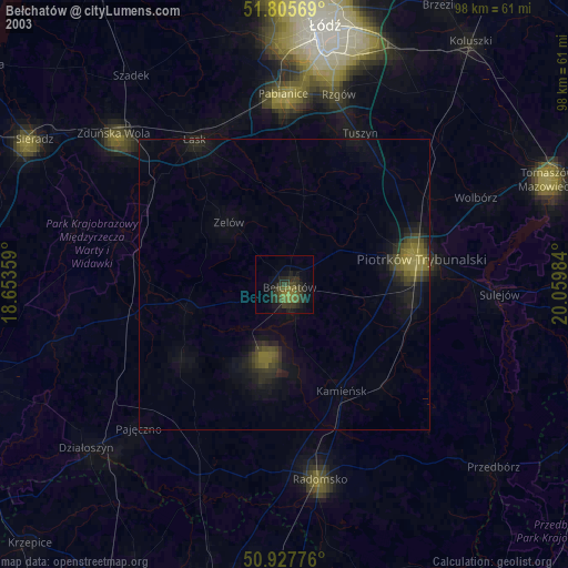
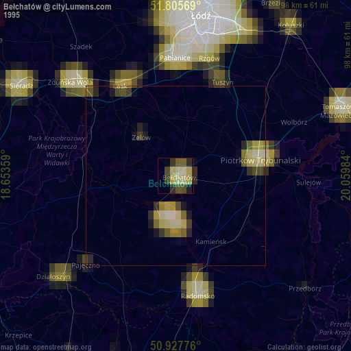
Bełchatów night lights from space
Night Light of Bełchatów (Łódź Voivodeship) from space (Poland) Src. Average luminocity for 10x10km area is 18.1611% and for 50x50km: 4.6057%.
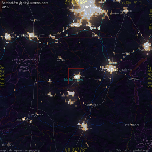
Analysis of Bełchatów night lights 2016
Square area 10x10 km:
 2.52%
2.52%90-99
4.34%80-89
1.96%70-79
1.96%60-69
1.54%50-59
2.24%40-49
1.68%30-39
0.84%20-29
1.26%10-19
16.25%0-9
65.41%Square area 50x50 km:
0.67%90-99
0.85%80-89
0.44%70-79
0.44%60-69
0.42%50-59
0.62%40-49
0.55%30-39
0.52%20-29
0.65%10-19
3.47%0-9
91.35%Clear (daylight) street map image can be seen on geolist.org.
Map coordinates:
51° 48' 20.5" North, 18° 39' 12.9" East
51° 22' 7.8" North, 19° 21' 24.2" East
50° 55' 39.9" North, 20° 3' 35.4" East
Some cities around Bełchatów sort by population:
• Piotrków Trybunalski
24.4 km =15.2 mi,  80°
80°
• Pabianice
32.9 km =20.4 mi,  359°
359°
• Radomsko
34.1 km =21.2 mi,  169°
169°
• Łask
29.1 km =18.1 mi,  327°
327°
• Zelów
14.3 km =8.9 mi,  318°
318°
• Tuszyn
29.3 km =18.2 mi,  24°
24°
• Pajęczno
35.4 km =22 mi,  225°
225°
• Ksawerów
35.1 km =21.8 mi,  5°
5°
3103709 (p: 62,896)
Sources (retrieved 2019-11-25):
» NASA, Earths city lights 1995
» NASA city lights 2003
» Earth at Night: Flat Maps 2012, 2016