Tuszyn night lights from space
Night Light of Tuszyn (Łódź Voivodeship) from space (Poland) Src. Average luminocity for 10x10km area is 14.8155% and for 50x50km: 15.2479%.
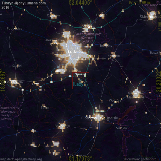
Analysis of Tuszyn night lights 2016
Square area 10x10 km:
 3.34%
3.34%90-99
2.01%80-89
1.34%70-79
1.87%60-69
0.94%50-59
1.2%40-49
0.53%30-39
0.94%20-29
3.48%10-19
16.84%0-9
67.51%Square area 50x50 km:
4.63%90-99
3.08%80-89
1.12%70-79
1.2%60-69
1.45%50-59
1.75%40-49
1.5%30-39
2.08%20-29
3.42%10-19
6.48%0-9
73.31%Clear (daylight) street map image can be seen on geolist.org.
Map coordinates:
52° 2' 38.6" North, 18° 49' 37.1" East
51° 36' 34.2" North, 19° 31' 48.3" East
51° 10' 14.6" North, 20° 13' 59.6" East
Some cities around Tuszyn sort by population:
• Łódź
18.3 km =11.4 mi,  347°
347°
• Piotrków Trybunalski
25.7 km =16 mi,  152°
152°
• Pabianice
13.6 km =8.5 mi,  296°
296°
• Konstantynów Łódzki
20.9 km =13 mi,  317°
317°
• Koluszki
24.6 km =15.3 mi,  54°
54°
• Brzeziny
26.1 km =16.2 mi,  35°
35°
• Zelów
26.8 km =16.7 mi,  233°
233°
• Ksawerów
12 km =7.5 mi,  312°
312°
3082945 (p: 7,124)
Sources (retrieved 2019-11-25):
» Earth at Night: Flat Maps 2012, 2016