Radomsko night lights from space
Night Light of Radomsko (Łódź Voivodeship) from space (Poland) Src. Average luminocity for 10x10km area is 24.2326% and for 50x50km: 3.3888%.
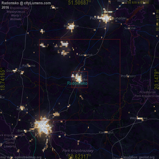
Analysis of Radomsko night lights 2016
Square area 10x10 km:
 4.68%
4.68%90-99
6.02%80-89
1.87%70-79
3.21%60-69
2.67%50-59
1.6%40-49
0.53%30-39
0.4%20-29
3.61%10-19
29.68%0-9
45.72%Square area 50x50 km:
0.4%90-99
0.59%80-89
0.2%70-79
0.43%60-69
0.35%50-59
0.44%40-49
0.43%30-39
0.47%20-29
0.59%10-19
3.26%0-9
92.82%Clear (daylight) street map image can be seen on geolist.org.
Map coordinates:
51° 30' 24.7" North, 18° 44' 29.9" East
51° 4' 1.7" North, 19° 26' 41.2" East
50° 37' 23.4" North, 20° 8' 52.4" East
Some cities around Radomsko sort by population:
• Częstochowa
37.6 km =23.4 mi,  216°
216°
• Piotrków Trybunalski
41.7 km =25.9 mi,  25°
25°
• Bełchatów
34.1 km =21.2 mi,  349°
349°
• Kłobuck
40.1 km =24.9 mi,  242°
242°
• Włoszczowa
43.6 km =27.1 mi,  123°
123°
• Pajęczno
32.5 km =20.2 mi,  285°
285°
• Koniecpol
36.7 km =22.8 mi,  152°
152°
• Działoszyn
40.8 km =25.4 mi,  277°
277°
3087497 (p: 49,175)
Sources (retrieved 2019-11-25):
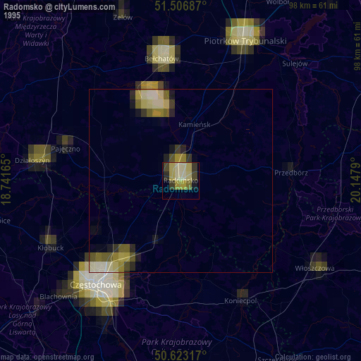
» NASA, Earths city lights 1995
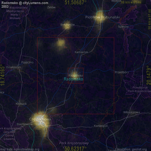
» NASA city lights 2003
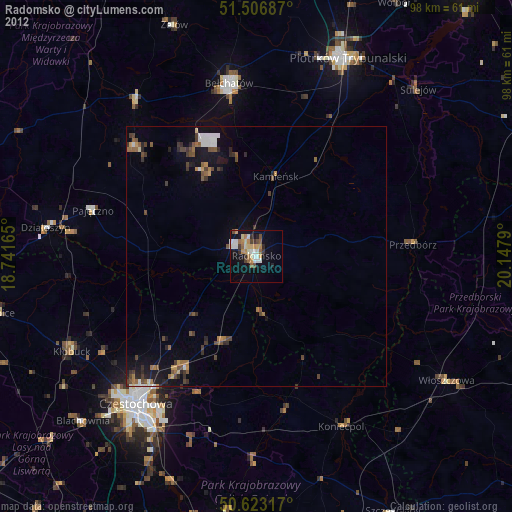
» Earth at Night: Flat Maps 2012, 2016