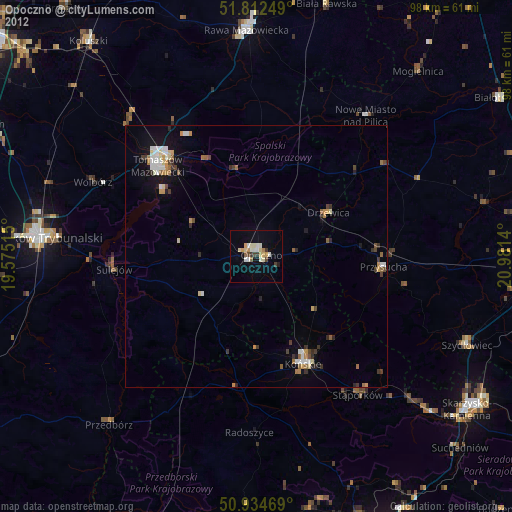
Opoczno night lights from space
Night Light of Opoczno (Łódź Voivodeship) from space (Poland) Src. Average luminocity for 10x10km area is 15.8333% and for 50x50km: 2.9832%.
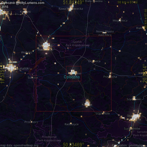
Analysis of Opoczno night lights 2016
Square area 10x10 km:
 3.36%
3.36%90-99
2.8%80-89
3.08%70-79
1.4%60-69
1.26%50-59
0.7%40-49
0.56%30-39
0.56%20-29
0.42%10-19
11.48%0-9
74.37%Square area 50x50 km:
0.5%90-99
0.61%80-89
0.31%70-79
0.24%60-69
0.27%50-59
0.32%40-49
0.33%30-39
0.26%20-29
0.31%10-19
2.37%0-9
94.51%Clear (daylight) street map image can be seen on geolist.org.
Map coordinates:
51° 48' 45" North, 19° 34' 30.5" East
51° 22' 32.5" North, 20° 16' 41.8" East
50° 56' 4.9" North, 20° 58' 53" East
Some cities around Opoczno sort by population:
• Piotrków Trybunalski
40 km =24.9 mi,  274°
274°
• Tomaszów Mazowiecki
25.5 km =15.8 mi,  312°
312°
• Końskie
22.3 km =13.9 mi,  156°
156°
• Rawa Mazowiecka
43.2 km =26.8 mi,  357°
357°
• Szydłowiec
43.7 km =27.2 mi,  112°
112°
• Sulejów
27.4 km =17 mi, 265°
• Przysucha
24.4 km =15.2 mi,  94°
94°
• Stąporków
33.4 km =20.8 mi,  142°
142°
763111 (p: 22,592)
Sources (retrieved 2019-11-25):
» Earth at Night: Flat Maps 2012, 2016