Piotrków Trybunalski night lights from space
Night Light of Piotrków Trybunalski (Łódź Voivodeship) from space (Poland) Src. Average luminocity for 10x10km area is 36.4916% and for 50x50km: 4.7058%.
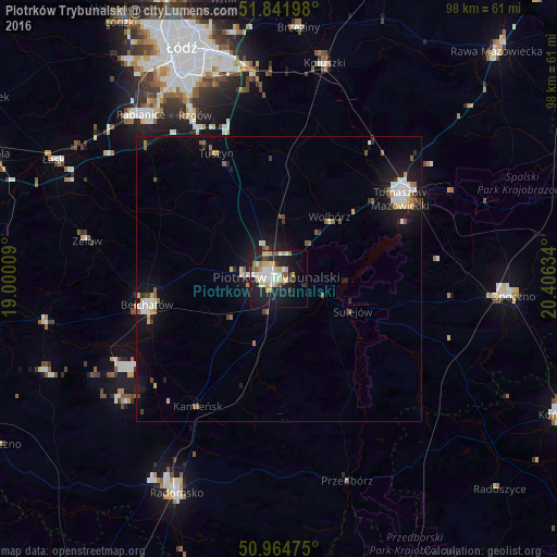
Analysis of Piotrków Trybunalski night lights 2016
Square area 10x10 km:
 7.56%
7.56%90-99
7.56%80-89
5.74%70-79
5.32%60-69
2.1%50-59
3.5%40-49
2.1%30-39
2.52%20-29
11.9%10-19
27.17%0-9
24.51%Square area 50x50 km:
0.69%90-99
0.84%80-89
0.53%70-79
0.44%60-69
0.35%50-59
0.66%40-49
0.3%30-39
0.47%20-29
0.91%10-19
4.9%0-9
89.91%Clear (daylight) street map image can be seen on geolist.org.
Map coordinates:
51° 50' 31.1" North, 19° 0' 0.3" East
51° 24' 19.7" North, 19° 42' 11.6" East
50° 57' 53.1" North, 20° 24' 22.8" East
Some cities around Piotrków Trybunalski sort by population:
• Pabianice
37.6 km =23.4 mi,  320°
320°
• Tomaszów Mazowiecki
25.4 km =15.8 mi,  56°
56°
• Bełchatów
24.4 km =15.2 mi,  260°
260°
• Koluszki
37.9 km =23.5 mi,  12°
12°
• Zelów
34.2 km =21.3 mi,  281°
281°
• Tuszyn
25.7 km =16 mi,  332°
332°
• Sulejów
13.9 km =8.6 mi,  114°
114°
• Ksawerów
37.2 km =23.1 mi, 326°
3088972 (p: 80,128)
Sources (retrieved 2019-11-25):
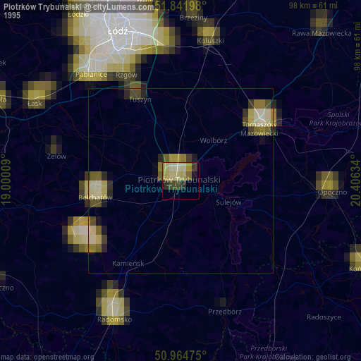
» NASA, Earths city lights 1995
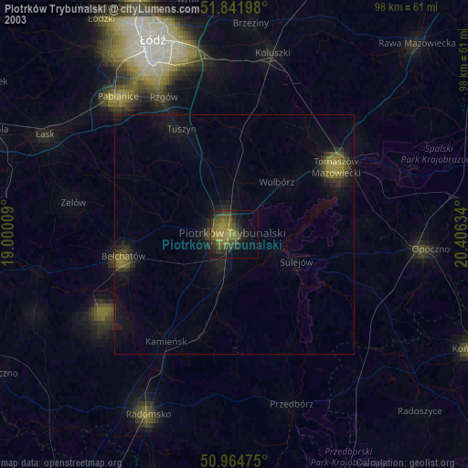
» NASA city lights 2003
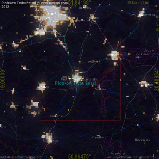
» Earth at Night: Flat Maps 2012, 2016