Koluszki night lights from space
Night Light of Koluszki (Łódź Voivodeship) from space (Poland) Src. Average luminocity for 10x10km area is 7.2969% and for 50x50km: 9.8498%.
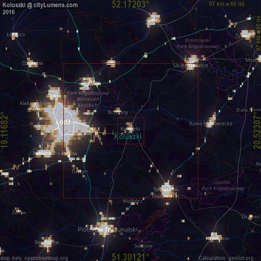
Analysis of Koluszki night lights 2016
Square area 10x10 km:
 0.56%
0.56%90-99
1.12%80-89
0%70-79
0%60-69
2.24%50-59
1.82%40-49
2.1%30-39
1.12%20-29
1.12%10-19
0%0-9
89.92%Square area 50x50 km:
2.89%90-99
1.81%80-89
0.61%70-79
0.71%60-69
0.92%50-59
1.01%40-49
0.97%30-39
1.19%20-29
2.06%10-19
6.77%0-9
81.05%Clear (daylight) street map image can be seen on geolist.org.
Map coordinates:
52° 10' 19.3" North, 19° 7' 0.6" East
51° 44' 19.4" North, 19° 49' 11.8" East
51° 18' 4.4" North, 20° 31' 23.1" East
Some cities around Koluszki sort by population:
• Łódź
24.1 km =15 mi,  278°
278°
• Tomaszów Mazowiecki
26.5 km =16.5 mi,  150°
150°
• Zgierz
31.3 km =19.4 mi,  294°
294°
• Rawa Mazowiecka
30.1 km =18.7 mi,  84°
84°
• Głowno
26.1 km =16.2 mi,  344°
344°
• Brzeziny
8.3 km =5.2 mi,  325°
325°
• Tuszyn
24.6 km =15.3 mi,  234°
234°
• Ksawerów
29.4 km =18.3 mi,  257°
257°
3095413 (p: 13,343)
Sources (retrieved 2019-11-25):
» Earth at Night: Flat Maps 2012, 2016