Skierniewice night lights from space
Night Light of Skierniewice (Łódź Voivodeship) from space (Poland) Src. Average luminocity for 10x10km area is 23.4609% and for 50x50km: 4.3628%.
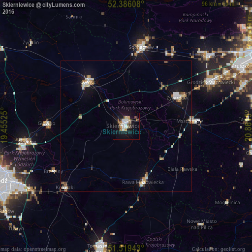
Analysis of Skierniewice night lights 2016
Square area 10x10 km:
 4.8%
4.8%90-99
3.91%80-89
2.02%70-79
2.15%60-69
4.04%50-59
1.89%40-49
3.41%30-39
1.01%20-29
2.65%10-19
25.63%0-9
48.48%Square area 50x50 km:
0.57%90-99
0.82%80-89
0.46%70-79
0.37%60-69
0.59%50-59
0.41%40-49
0.56%30-39
0.37%20-29
0.41%10-19
3.22%0-9
92.22%Clear (daylight) street map image can be seen on geolist.org.
Map coordinates:
52° 23' 9.9" North, 19° 27' 18.9" East
51° 57' 17.5" North, 20° 9' 30.1" East
51° 31' 9.9" North, 20° 51' 41.4" East
Some cities around Skierniewice sort by population:
• Żyrardów
22.3 km =13.9 mi,  62°
62°
• Sochaczew
31 km =19.3 mi,  10°
10°
• Łowicz
22.3 km =13.9 mi,  319°
319°
• Rawa Mazowiecka
22.2 km =13.8 mi,  162°
162°
• Głowno
30.4 km =18.9 mi,  272°
272°
• Koluszki
33.4 km =20.8 mi,  224°
224°
• Brzeziny
32.8 km =20.4 mi,  238°
238°
• Mszczonów
24.9 km =15.5 mi,  85°
85°
759123 (p: 49,042)
Sources (retrieved 2019-11-25):
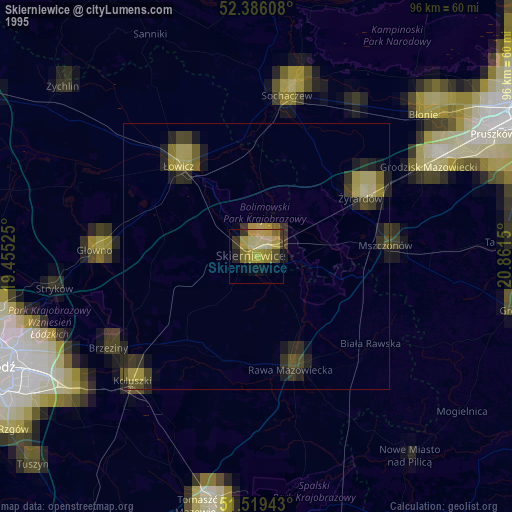
» NASA, Earths city lights 1995
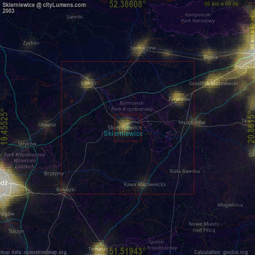
» NASA city lights 2003
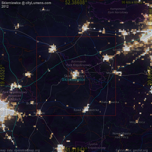
» Earth at Night: Flat Maps 2012, 2016