Brzeziny night lights from space
Night Light of Brzeziny (Łódź Voivodeship) from space (Poland) Src. Average luminocity for 10x10km area is 5.7703% and for 50x50km: 12.4743%.
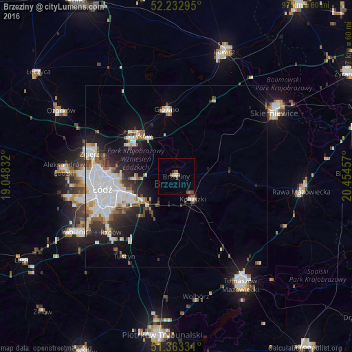
Analysis of Brzeziny night lights 2016
Square area 10x10 km:
 0.42%
0.42%90-99
0.7%80-89
0.56%70-79
0%60-69
1.26%50-59
2.24%40-49
1.26%30-39
0.14%20-29
0.42%10-19
0%0-9
93%Square area 50x50 km:
4.1%90-99
2.6%80-89
0.77%70-79
0.82%60-69
1.15%50-59
1.19%40-49
1.09%30-39
1.39%20-29
2.41%10-19
6.48%0-9
78%Clear (daylight) street map image can be seen on geolist.org.
Map coordinates:
52° 13' 58.6" North, 19° 2' 54" East
51° 48' 0.8" North, 19° 45' 5.2" East
51° 21' 47.9" North, 20° 27' 16.5" East
Some cities around Brzeziny sort by population:
• Łódź
19.4 km =12.1 mi,  260°
260°
• Zgierz
24.5 km =15.2 mi,  284°
284°
• Aleksandrów Łódzki
30.8 km =19.1 mi,  274°
274°
• Konstantynów Łódzki
29.9 km =18.6 mi, 258°
• Głowno
18.4 km =11.4 mi,  352°
352°
• Koluszki
8.3 km =5.2 mi,  145°
145°
• Tuszyn
26.1 km =16.2 mi,  215°
215°
• Ksawerów
27.3 km =17 mi,  241°
241°
3102390 (p: 12,289)
Sources (retrieved 2019-11-25):
» Earth at Night: Flat Maps 2012, 2016