Głowno night lights from space
Night Light of Głowno (Łódź Voivodeship) from space (Poland) Src. Average luminocity for 10x10km area is 8.8851% and for 50x50km: 10.1791%.
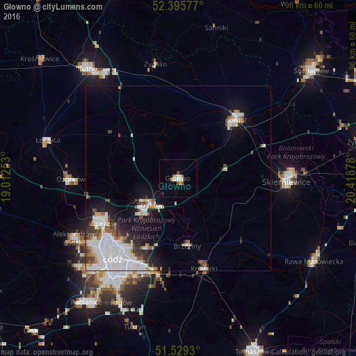
Analysis of Głowno night lights 2016
Square area 10x10 km:
 0.76%
0.76%90-99
2.27%80-89
0.63%70-79
1.39%60-69
1.39%50-59
0.63%40-49
0.51%30-39
0%20-29
1.01%10-19
1.14%0-9
90.28%Square area 50x50 km:
3.57%90-99
2.18%80-89
0.61%70-79
0.65%60-69
0.91%50-59
0.82%40-49
0.93%30-39
0.94%20-29
1.4%10-19
5.02%0-9
82.98%Clear (daylight) street map image can be seen on geolist.org.
Map coordinates:
52° 23' 44.8" North, 19° 0' 45.1" East
51° 57' 52.7" North, 19° 42' 56.3" East
51° 31' 45.5" North, 20° 25' 7.6" East
Some cities around Głowno sort by population:
• Łódź
27.2 km =16.9 mi,  217°
217°
• Zgierz
24.4 km =15.2 mi,  240°
240°
• Skierniewice
30.4 km =18.9 mi,  92°
92°
• Łowicz
22.3 km =13.9 mi,  44°
44°
• Ozorków
29.1 km =18.1 mi,  269°
269°
• Koluszki
26.1 km =16.2 mi,  164°
164°
• Brzeziny
18.4 km =11.4 mi,  172°
172°
• Żychlin
31.7 km =19.7 mi,  348°
348°
3099180 (p: 15,103)
Sources (retrieved 2019-11-25):
» Earth at Night: Flat Maps 2012, 2016