Opole night lights from space
Night Light of Opole (Opole Voivodeship) from space (Poland) Src. Average luminocity for 10x10km area is 50.6698% and for 50x50km: 4.7913%.
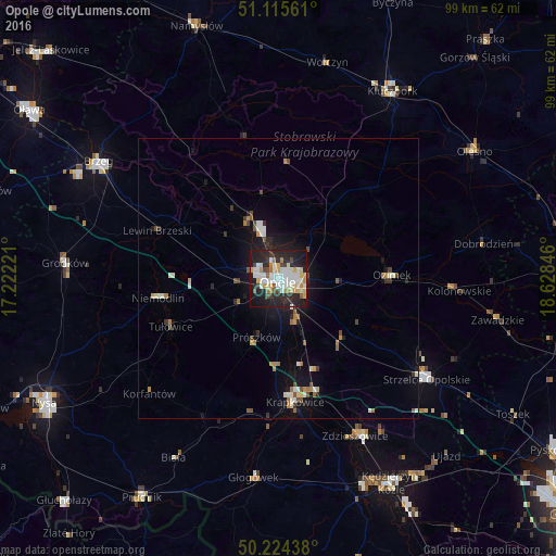
Analysis of Opole night lights 2016
Square area 10x10 km:
 12.3%
12.3%90-99
14.04%80-89
4.95%70-79
6.55%60-69
3.88%50-59
1.47%40-49
4.68%30-39
3.21%20-29
23.53%10-19
24.06%0-9
1.34%Square area 50x50 km:
0.65%90-99
1.05%80-89
0.35%70-79
0.44%60-69
0.61%50-59
0.39%40-49
0.65%30-39
0.43%20-29
1.32%10-19
3.85%0-9
90.27%Clear (daylight) street map image can be seen on geolist.org.
Map coordinates:
51° 6' 56.2" North, 17° 13' 20" East
50° 40' 19.6" North, 17° 55' 31.2" East
50° 13' 27.8" North, 18° 37' 42.5" East
Some cities around Opole sort by population:
• Strzelce Opolskie
32 km =19.9 mi,  124°
124°
• Krapkowice
22.1 km =13.7 mi,  172°
172°
• Zdzieszowice
30.9 km =19.2 mi,  153°
153°
• Ozimek
20.3 km =12.6 mi,  87°
87°
• Niemodlin
21.8 km =13.5 mi,  261°
261°
• Gogolin
21.1 km =13.1 mi,  161°
161°
• Lewin Brzeski
23.3 km =14.5 mi,  291°
291°
• Głogówek
35.7 km =22.2 mi,  186°
186°
3090048 (p: 127,676)
Sources (retrieved 2019-11-25):
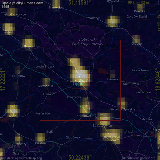
» NASA, Earths city lights 1995
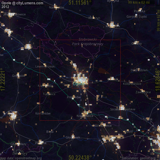
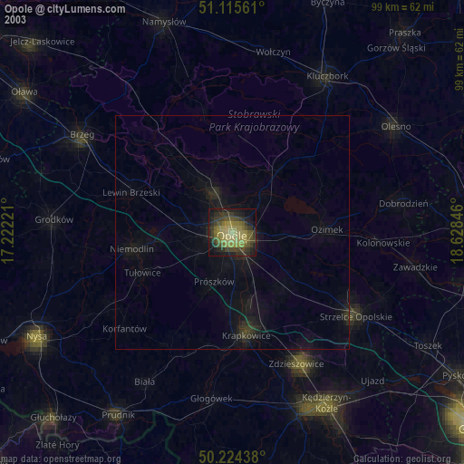
» NASA city lights 2003
» Earth at Night: Flat Maps 2012, 2016