Gogolin night lights from space
Night Light of Gogolin (Opole Voivodeship) from space (Poland) Src. Average luminocity for 10x10km area is 16.1835% and for 50x50km: 6.4159%.
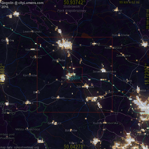
Analysis of Gogolin night lights 2016
Square area 10x10 km:
 1.54%
1.54%90-99
3.36%80-89
2.52%70-79
1.4%60-69
1.82%50-59
2.1%40-49
3.36%30-39
0.98%20-29
0.7%10-19
15.97%0-9
66.25%Square area 50x50 km:
0.84%90-99
1.3%80-89
0.5%70-79
0.59%60-69
0.86%50-59
0.73%40-49
0.84%30-39
0.62%20-29
1.37%10-19
4.65%0-9
87.71%Clear (daylight) street map image can be seen on geolist.org.
Map coordinates:
50° 56' 14.7" North, 17° 19' 0.6" East
50° 29' 32" North, 18° 1' 11.8" East
50° 2' 34" North, 18° 43' 23.1" East
Some cities around Gogolin sort by population:
• Opole
21.1 km =13.1 mi,  341°
341°
• Kędzierzyn-Koźle
21.5 km =13.4 mi,  137°
137°
• Strzelce Opolskie
20 km =12.4 mi,  84°
84°
• Krapkowice
4.3 km =2.7 mi,  243°
243°
• Koźle
19.5 km =12.1 mi,  153°
153°
• Zdzieszowice
10.5 km =6.5 mi, 135°
• Ozimek
24.9 km =15.5 mi,  33°
33°
• Głogówek
19 km =11.8 mi,  215°
215°
3099048 (p: 6,077)
Sources (retrieved 2019-11-25):
» Earth at Night: Flat Maps 2012, 2016