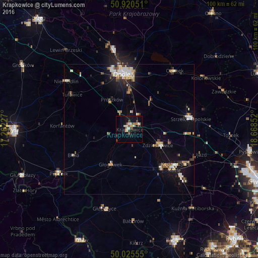
Krapkowice night lights from space
Night Light of Krapkowice (Opole Voivodeship) from space (Poland) Src. Average luminocity for 10x10km area is 17.0378% and for 50x50km: 6.2689%.
Analysis of Krapkowice night lights 2016
Square area 10x10 km:
 1.68%
1.68%90-99
3.36%80-89
2.24%70-79
0.98%60-69
1.82%50-59
2.94%40-49
3.22%30-39
0.84%20-29
0.98%10-19
16.25%0-9
65.69%Square area 50x50 km:
0.83%90-99
1.42%80-89
0.5%70-79
0.59%60-69
0.82%50-59
0.69%40-49
0.8%30-39
0.56%20-29
1.04%10-19
4.25%0-9
88.49%Clear (daylight) street map image can be seen on geolist.org.
Map coordinates:
50° 55' 13.8" North, 17° 15' 44.2" East
50° 28' 30.5" North, 17° 57' 55.4" East
50° 1' 32" North, 18° 40' 6.7" East
Some cities around Krapkowice sort by population:
• Opole
22.1 km =13.7 mi,  352°
352°
• Kędzierzyn-Koźle
23.1 km =14.4 mi,  127°
127°
• Strzelce Opolskie
24 km =14.9 mi,  80°
80°
• Koźle
20 km =12.4 mi,  140°
140°
• Zdzieszowice
12.5 km =7.8 mi,  116°
116°
• Ozimek
28.7 km =17.8 mi,  37°
37°
• Gogolin
4.3 km =2.7 mi,  63°
63°
• Głogówek
15.3 km =9.5 mi,  207°
207°
3094788 (p: 18,275)
Sources (retrieved 2019-11-25):
» Earth at Night: Flat Maps 2012, 2016