Zdzieszowice night lights from space
Night Light of Zdzieszowice (Opole Voivodeship) from space (Poland) Src. Average luminocity for 10x10km area is 11.1807% and for 50x50km: 4.5491%.
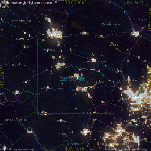
Analysis of Zdzieszowice night lights 2016
Square area 10x10 km:
 0.98%
0.98%90-99
1.82%80-89
1.12%70-79
1.26%60-69
1.96%50-59
1.68%40-49
1.68%30-39
0.7%20-29
0%10-19
0%0-9
88.8%Square area 50x50 km:
0.35%90-99
0.73%80-89
0.33%70-79
0.42%60-69
0.7%50-59
0.69%40-49
0.63%30-39
0.57%20-29
0.79%10-19
3.57%0-9
91.22%Clear (daylight) street map image can be seen on geolist.org.
Map coordinates:
50° 52' 14.4" North, 17° 25' 13.3" East
50° 25' 29.4" North, 18° 7' 24.6" East
49° 58' 29.1" North, 18° 49' 35.8" East
Some cities around Zdzieszowice sort by population:
• Kędzierzyn-Koźle
11.1 km =6.9 mi,  138°
138°
• Strzelce Opolskie
15.8 km =9.8 mi,  52°
52°
• Krapkowice
12.5 km =7.8 mi,  296°
296°
• Koźle
10 km =6.2 mi,  171°
171°
• Ozimek
29 km =18 mi,  12°
12°
• Gogolin
10.5 km =6.5 mi,  315°
315°
• Głogówek
20 km =12.4 mi,  246°
246°
• Kuźnia Raciborska
28.3 km =17.6 mi,  151°
151°
3080389 (p: 13,401)
Sources (retrieved 2019-11-25):
» Earth at Night: Flat Maps 2012, 2016