Przysucha night lights from space
Night Light of Przysucha (Mazovia) from space (Poland) Src. Average luminocity for 10x10km area is 3.619% and for 50x50km: 2.093%.
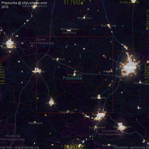
Analysis of Przysucha night lights 2016
Square area 10x10 km:
 0%
0%90-99
0.7%80-89
0.98%70-79
0.56%60-69
0%50-59
0%40-49
1.68%30-39
0%20-29
1.68%10-19
0.56%0-9
93.84%Square area 50x50 km:
0.18%90-99
0.31%80-89
0.19%70-79
0.17%60-69
0.31%50-59
0.26%40-49
0.4%30-39
0.29%20-29
0.4%10-19
1.3%0-9
96.19%Clear (daylight) street map image can be seen on geolist.org.
Map coordinates:
51° 47' 43.9" North, 19° 55' 32.8" East
51° 21' 30.9" North, 20° 37' 44" East
50° 55' 2.7" North, 21° 19' 55.3" East
Some cities around Przysucha sort by population:
• Radom
36.3 km =22.6 mi,  82°
82°
• Skarżysko-Kamienna
32.1 km =19.9 mi,  148°
148°
• Opoczno
24.4 km =15.2 mi,  274°
274°
• Końskie
24.2 km =15 mi,  219°
219°
• Szydłowiec
21.7 km =13.5 mi,  131°
131°
• Suchedniów
37.3 km =23.2 mi,  158°
158°
• Białobrzegi
39 km =24.2 mi,  34°
34°
• Stąporków
24.9 km =15.5 mi,  189°
189°
761008 (p: 6,188)
Sources (retrieved 2019-11-25):
» Earth at Night: Flat Maps 2012, 2016