Szydłowiec night lights from space
Night Light of Szydłowiec (Mazovia) from space (Poland) Src. Average luminocity for 10x10km area is 5.5994% and for 50x50km: 7.1006%.
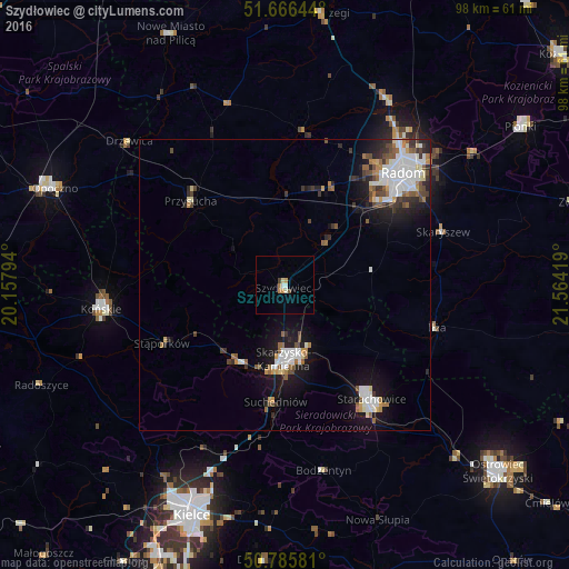
Analysis of Szydłowiec night lights 2016
Square area 10x10 km:
 0.42%
0.42%90-99
1.26%80-89
0.56%70-79
1.12%60-69
0.98%50-59
0.42%40-49
0.7%30-39
0.14%20-29
0%10-19
0%0-9
94.4%Square area 50x50 km:
1.53%90-99
1.59%80-89
0.45%70-79
0.54%60-69
0.74%50-59
0.91%40-49
0.93%30-39
0.82%20-29
1.32%10-19
4.77%0-9
86.41%Clear (daylight) street map image can be seen on geolist.org.
Map coordinates:
51° 39' 59.2" North, 20° 9' 28.6" East
51° 13' 41.6" North, 20° 51' 39.8" East
50° 47' 8.9" North, 21° 33' 51.1" East
Some cities around Szydłowiec sort by population:
• Radom
27.8 km =17.3 mi,  45°
45°
• Starachowice
25.8 km =16 mi,  145°
145°
• Skarżysko-Kamienna
12.8 km =8 mi,  176°
176°
• Końskie
32 km =19.9 mi,  262°
262°
• Suchedniów
20.2 km =12.6 mi,  186°
186°
• Przysucha
21.7 km =13.5 mi,  311°
311°
• Stąporków
22.5 km =14 mi,  243°
243°
• Iłża
27.4 km =17 mi,  105°
105°
757178 (p: 12,128)
Sources (retrieved 2019-11-25):
» Earth at Night: Flat Maps 2012, 2016