Maków Mazowiecki night lights from space
Night Light of Maków Mazowiecki (Mazovia) from space (Poland) Src. Average luminocity for 10x10km area is 3.4912% and for 50x50km: 1.1972%.
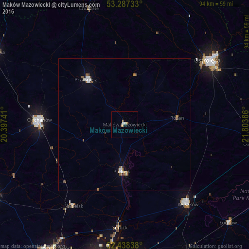
Analysis of Maków Mazowiecki night lights 2016
Square area 10x10 km:
 0.63%
0.63%90-99
0.38%80-89
0.88%70-79
0.63%60-69
0.51%50-59
0.51%40-49
0%30-39
0%20-29
0%10-19
0.51%0-9
95.96%Square area 50x50 km:
0.2%90-99
0.22%80-89
0.08%70-79
0.15%60-69
0.2%50-59
0.13%40-49
0.12%30-39
0.14%20-29
0.01%10-19
0.13%0-9
98.63%Clear (daylight) street map image can be seen on geolist.org.
Map coordinates:
53° 17' 14.4" North, 20° 23' 50.7" East
52° 51' 53.7" North, 21° 6' 1.9" East
52° 26' 18.2" North, 21° 48' 13.2" East
Some cities around Maków Mazowiecki sort by population:
• Ostrołęka
40.2 km =25 mi,  52°
52°
• Legionowo
52.8 km =32.8 mi,  192°
192°
• Ciechanów
32.3 km =20.1 mi,  273°
273°
• Wyszków
38.7 km =24 mi,  141°
141°
• Pułtusk
18.1 km =11.2 mi,  183°
183°
• Przasnysz
22.6 km =14 mi,  319°
319°
• Radzymin
50.2 km =31.2 mi,  173°
173°
• Nasielsk
36.6 km =22.7 mi,  212°
212°
765430 (p: 9,978)
Sources (retrieved 2019-11-25):
» Earth at Night: Flat Maps 2012, 2016