Pasay night lights from space
Night Light of Pasay (Metro Manila) from space (Philippines) Src. Average luminocity for 10x10km area is 88.2684% and for 50x50km: 45.512%.
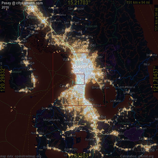
Analysis of Pasay night lights 2016
Square area 10x10 km:
 63.2%
63.2%90-99
14.07%80-89
1.3%70-79
1.73%60-69
2.38%50-59
3.46%40-49
5.63%30-39
8.23%20-29
0%10-19
0%0-9
0%Square area 50x50 km:
14.86%90-99
9.42%80-89
5.1%70-79
7.63%60-69
6.27%50-59
2.36%40-49
2.76%30-39
4.87%20-29
6.49%10-19
8.17%0-9
32.07%Clear (daylight) street map image can be seen on geolist.org.
Map coordinates:
15° 13' 1.3" North, 120° 17' 54" East
14° 32' 14.9" North, 121° 0' 5.2" East
13° 51' 21" North, 121° 42' 16.5" East
Some cities around Pasay sort by population:
• Manila
7.7 km =4.8 mi,  344°
344°
• Taguig
8.5 km =5.3 mi,  99°
99°
• Pasig City
8.5 km =5.3 mi,  49°
49°
• Makati City
3.7 km =2.3 mi,  67°
67°
• Mandaluyong City
6.6 km =4.1 mi,  39°
39°
• San Juan
7.8 km =4.8 mi,  26°
26°
• Port Area
6.3 km =3.9 mi,  323°
323°
• Quiapo
7.2 km =4.5 mi, 344°
1694611 (p: 416,522)
Sources (retrieved 2019-11-25):
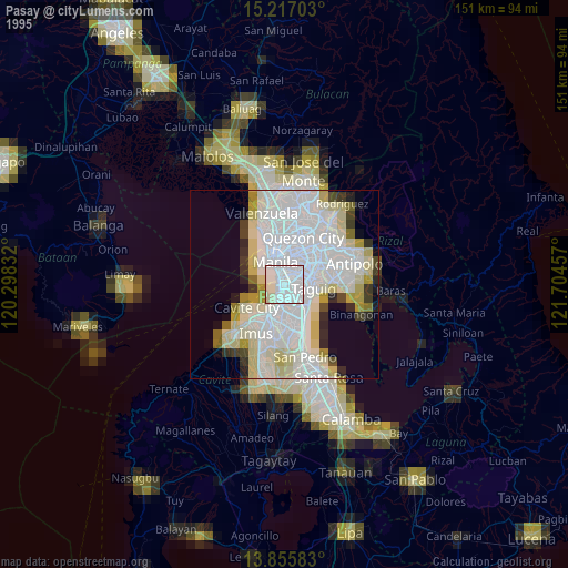
» NASA, Earths city lights 1995
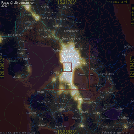
» NASA city lights 2003
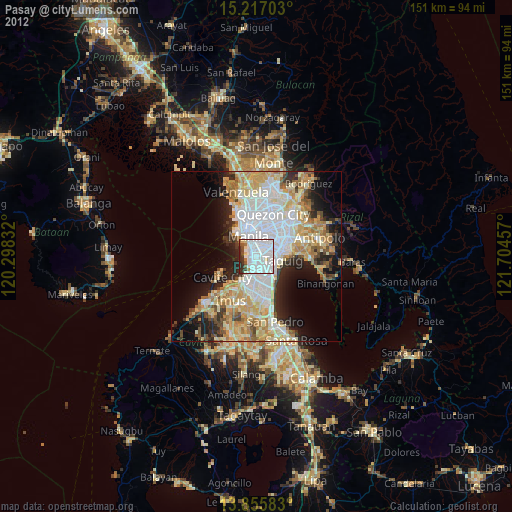
» Earth at Night: Flat Maps 2012, 2016