Pasig City night lights from space
Night Light of Pasig City (Metro Manila) from space (Philippines) Src. Average luminocity for 10x10km area is 99.7857% and for 50x50km: 44.8536%.
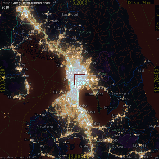
Analysis of Pasig City night lights 2016
Square area 10x10 km:
 87.88%
90-99
11.9%80-89
0%70-79
0.22%60-69
0%50-59
0%40-49
0%30-39
0%20-29
0%10-19
0%0-9
0%Square area 50x50 km:
14.43%90-99
8.9%80-89
4.74%70-79
7.45%60-69
6.61%50-59
2.66%40-49
2.79%30-39
5%20-29
6.93%10-19
8.9%0-9
31.59%Clear (daylight) street map image can be seen on geolist.org.
Map coordinates:
15° 15' 58.7" North, 120° 21' 29.8" East
14° 35' 12.9" North, 121° 3' 41" East
13° 54' 19.5" North, 121° 45' 52.3" East
Some cities around Pasig City sort by population:
• Quezon City
7 km =4.3 mi,  350°
350°
• Taguig
7.2 km =4.5 mi,  164°
164°
• Makati City
5.1 km =3.2 mi,  217°
217°
• Mandaluyong City
2.2 km =1.4 mi,  259°
259°
• Cainta
6.6 km =4.1 mi,  98°
98°
• San Juan
3.4 km =2.1 mi,  295°
295°
• Calumpang
5 km =3.1 mi,  37°
37°
• Del Monte
7.7 km =4.8 mi,  322°
322°
7290466 (p: 617,301)
Sources (retrieved 2019-11-25):
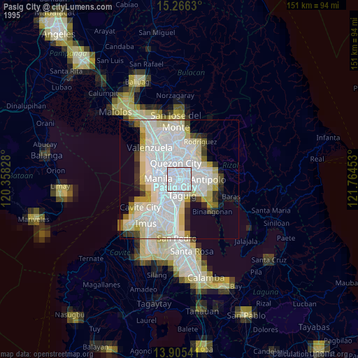
» NASA, Earths city lights 1995
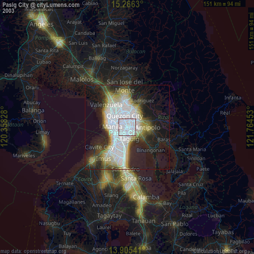
» NASA city lights 2003
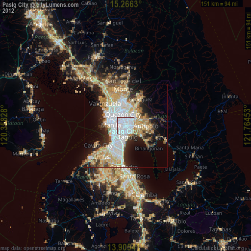
» Earth at Night: Flat Maps 2012, 2016