Makati City night lights from space
Night Light of Makati City (Metro Manila) from space (Philippines) Src. Average luminocity for 10x10km area is 99.4978% and for 50x50km: 45.5011%.
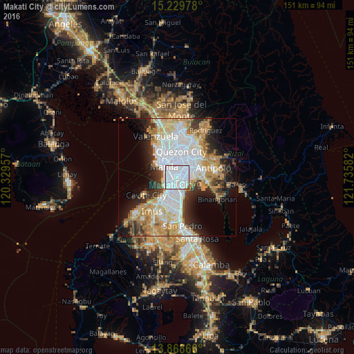
Analysis of Makati City night lights 2016
Square area 10x10 km:
 81.82%
90-99
17.32%80-89
0%70-79
0.87%60-69
0%50-59
0%40-49
0%30-39
0%20-29
0%10-19
0%0-9
0%Square area 50x50 km:
14.75%90-99
9.19%80-89
5.11%70-79
7.63%60-69
6.24%50-59
2.33%40-49
2.86%30-39
5.04%20-29
6.77%10-19
9.05%0-9
31.02%Clear (daylight) street map image can be seen on geolist.org.
Map coordinates:
15° 13' 47.2" North, 120° 19' 46.5" East
14° 33' 1" North, 121° 1' 57.7" East
13° 52' 7.2" North, 121° 44' 9" East
Some cities around Makati City sort by population:
• Manila
8.1 km =5 mi,  317°
317°
• Taguig
5.8 km =3.6 mi,  119°
119°
• Pasig City
5.1 km =3.2 mi,  37°
37°
• Pasay
3.7 km =2.3 mi,  247°
247°
• Mandaluyong City
3.8 km =2.4 mi,  13°
13°
• San Juan
5.5 km =3.4 mi,  0°
0°
• Port Area
8 km =5 mi,  297°
297°
• Quiapo
7.7 km =4.8 mi, 316°
1703417 (p: 510,383)
Sources (retrieved 2019-11-25):
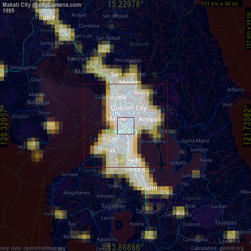
» NASA, Earths city lights 1995
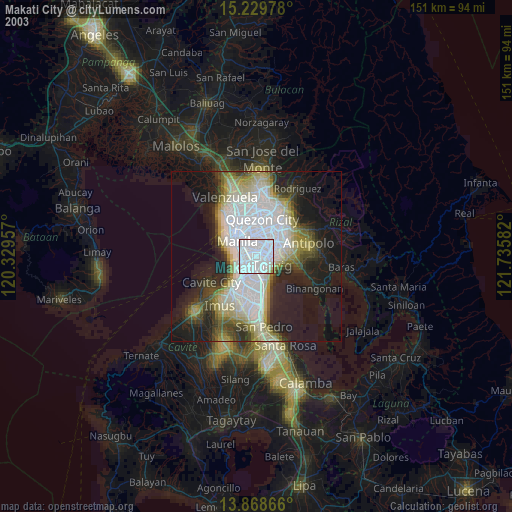
» NASA city lights 2003
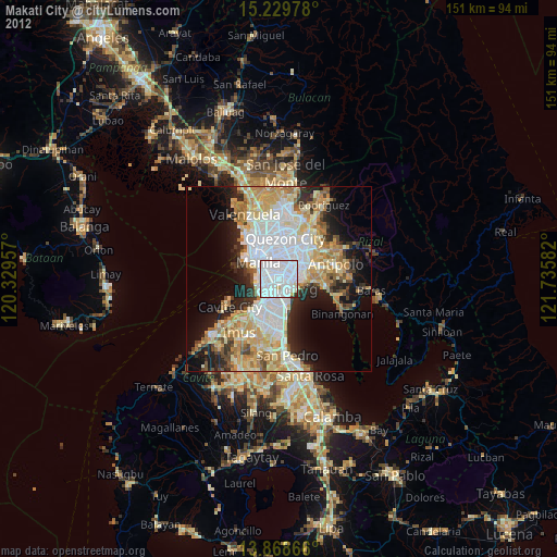
» Earth at Night: Flat Maps 2012, 2016