Taguig night lights from space
Night Light of Taguig (Metro Manila) from space (Philippines) Src. Average luminocity for 10x10km area is 77.829% and for 50x50km: 45.7099%.
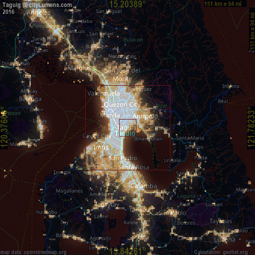

Analysis of Taguig night lights 2016
Square area 10x10 km:
 37.45%
90-99
19.91%80-89
3.03%70-79
6.71%60-69
7.36%50-59
1.52%40-49
4.33%30-39
10.61%20-29
7.36%10-19
1.73%0-9
0%Square area 50x50 km:
14.86%90-99
9.34%80-89
4.96%70-79
7.99%60-69
6.36%50-59
2.3%40-49
3.02%30-39
4.93%20-29
6.37%10-19
7.8%0-9
32.06%Clear (daylight) street map image can be seen on geolist.org.
Map coordinates:
15° 12' 14" North, 120° 22' 33.9" East
14° 31' 27.5" North, 121° 4' 45.1" East
13° 50' 33.4" North, 121° 46' 56.4" East
Some cities around Taguig sort by population:
• Pasig City
7.2 km =4.5 mi,  344°
344°
• Makati City
5.8 km =3.6 mi,  299°
299°
• Pasay
8.5 km =5.3 mi,  279°
279°
• Mandaluyong City
7.7 km =4.8 mi,  327°
327°
• Cainta
7.6 km =4.7 mi,  37°
37°
• Taytay
6.9 km =4.3 mi,  56°
56°
• San Juan
9.8 km =6.1 mi, 329°
• Angono
8 km =5 mi,  88°
88°
1684308 (p: 644,473)
Sources (retrieved 2019-11-25):
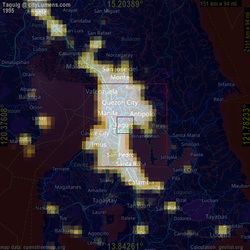
» NASA, Earths city lights 1995
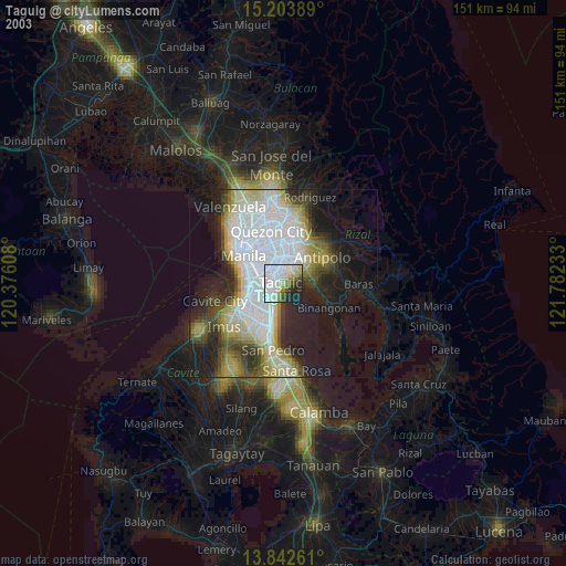
» NASA city lights 2003
» Earth at Night: Flat Maps 2012, 2016