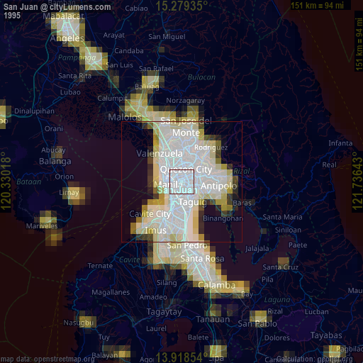
San Juan night lights from space
Night Light of San Juan (Metro Manila) from space (Philippines) Src. Average luminocity for 10x10km area is 99.8745% and for 50x50km: 44.7154%.
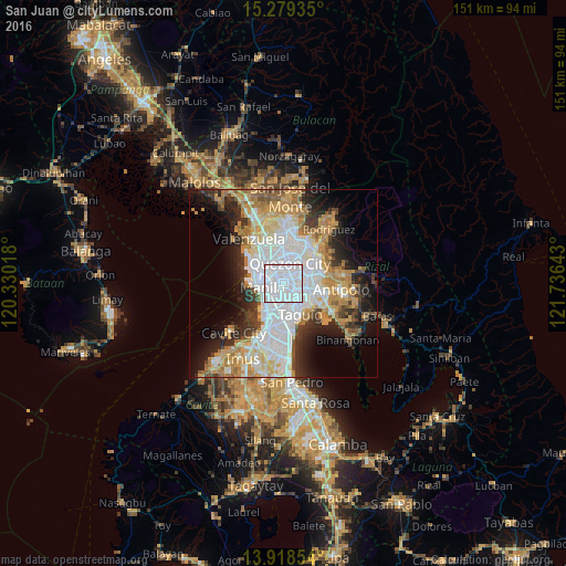
Analysis of San Juan night lights 2016
Square area 10x10 km:
 90.69%
90-99
9.31%80-89
0%70-79
0%60-69
0%50-59
0%40-49
0%30-39
0%20-29
0%10-19
0%0-9
0%Square area 50x50 km:
14.38%90-99
8.68%80-89
4.68%70-79
7.5%60-69
6.67%50-59
2.75%40-49
2.83%30-39
4.89%20-29
6.86%10-19
9.62%0-9
31.14%Clear (daylight) street map image can be seen on geolist.org.
Map coordinates:
15° 16' 45.7" North, 120° 19' 48.6" East
14° 36' 0" North, 121° 1' 59.9" East
13° 55' 6.7" North, 121° 44' 11.1" East
Some cities around San Juan sort by population:
• Quezon City
5.7 km =3.5 mi,  19°
19°
• Manila
5.5 km =3.4 mi,  274°
274°
• Pasig City
3.4 km =2.1 mi,  115°
115°
• Makati City
5.5 km =3.4 mi,  180°
180°
• Mandaluyong City
2 km =1.2 mi,  156°
156°
• Quiapo
5.4 km =3.4 mi, 270°
• Calumpang
6.6 km =4.1 mi,  67°
67°
• Del Monte
4.9 km =3 mi,  340°
340°
1689286 (p: 121,430)
Sources (retrieved 2019-11-25):
» NASA, Earths city lights 1995
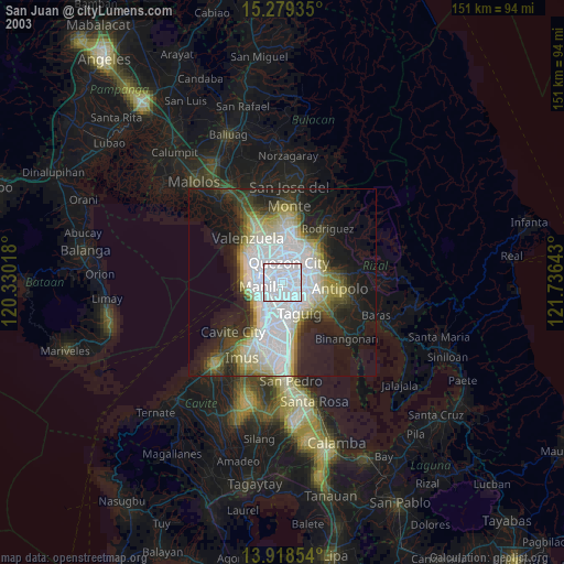
» NASA city lights 2003
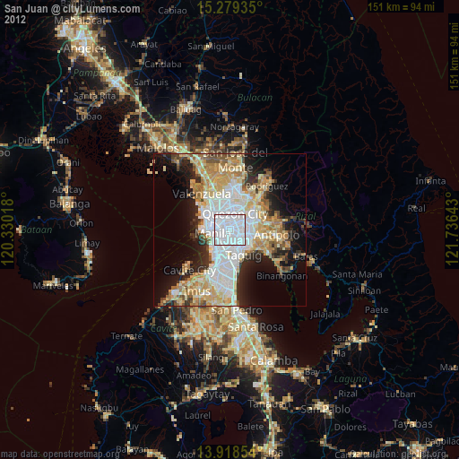
» Earth at Night: Flat Maps 2012, 2016