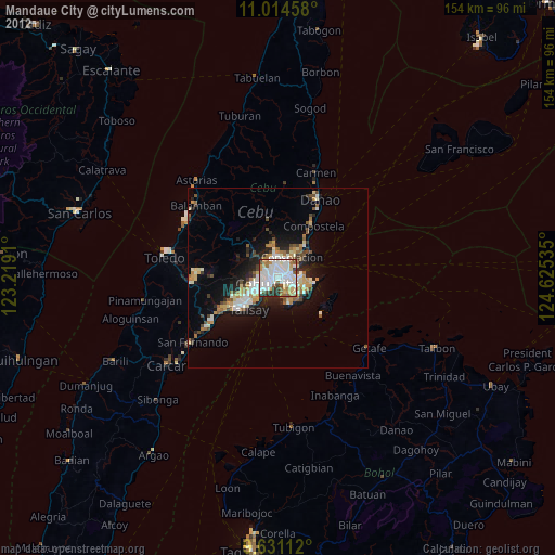
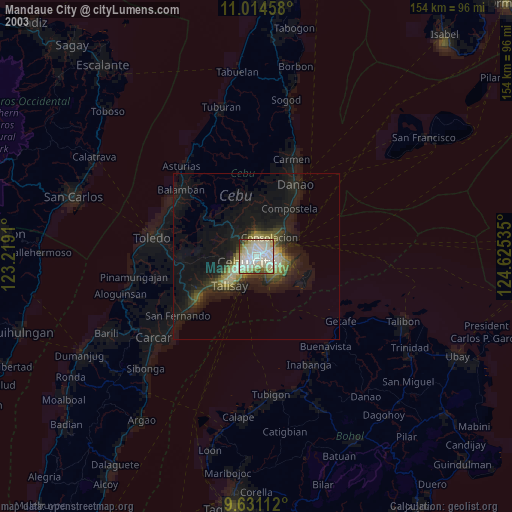
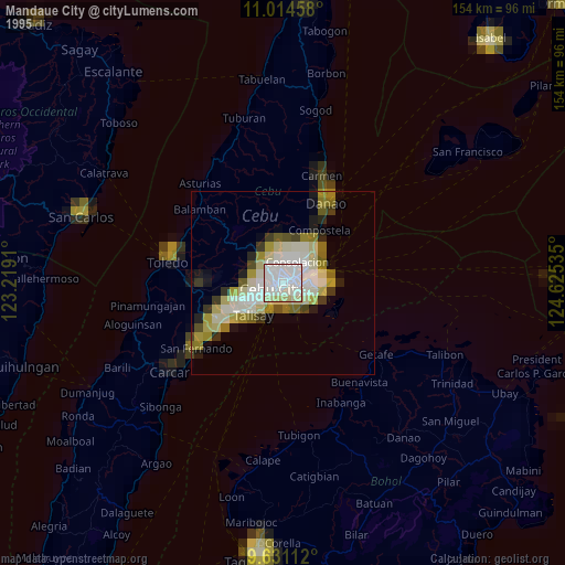
Mandaue City night lights from space
Night Light of Mandaue City (Central Visayas) from space (Philippines) Src. Average luminocity for 10x10km area is 88.8946% and for 50x50km: 14.7633%.
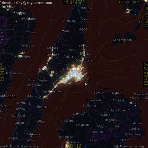
Analysis of Mandaue City night lights 2016
Square area 10x10 km:
 37.81%
90-99
32.85%80-89
6.61%70-79
5.17%60-69
7.02%50-59
4.34%40-49
3.93%30-39
2.27%20-29
0%10-19
0%0-9
0%Square area 50x50 km:
2.88%90-99
2.8%80-89
1.82%70-79
1.57%60-69
2.06%50-59
1.06%40-49
1.84%30-39
1.87%20-29
4.06%10-19
8.12%0-9
71.92%Clear (daylight) street map image can be seen on geolist.org.
Map coordinates:
11° 0' 52.5" North, 123° 13' 8.8" East
10° 19' 25" North, 123° 55' 20" East
9° 37' 52" North, 124° 37' 31.3" East
Some cities around Mandaue City sort by population:
• Cebu City
3.5 km =2.2 mi,  257°
257°
• Lapu-Lapu City
3.3 km =2.1 mi,  116°
116°
• Talisay
11.8 km =7.3 mi,  222°
222°
• Consolacion
7 km =4.3 mi,  33°
33°
• Cordova
9.1 km =5.7 mi,  166°
166°
• Apas
2.9 km =1.8 mi,  311°
311°
• Jaclupan
11.8 km =7.3 mi, 257°
• Tayud
11 km =6.8 mi,  55°
55°
1701947 (p: 331,320)
Sources (retrieved 2019-11-25):
» NASA, Earths city lights 1995
» NASA city lights 2003
» Earth at Night: Flat Maps 2012, 2016