Talisay night lights from space
Night Light of Talisay (Central Visayas) from space (Philippines) Src. Average luminocity for 10x10km area is 49.1302% and for 50x50km: 15.3293%.
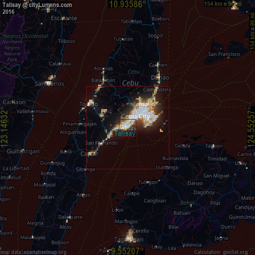

Analysis of Talisay night lights 2016
Square area 10x10 km:
 12.6%
12.6%90-99
11.78%80-89
5.37%70-79
6.61%60-69
4.96%50-59
3.51%40-49
3.31%30-39
5.99%20-29
14.46%10-19
22.11%0-9
9.3%Square area 50x50 km:
2.92%90-99
2.86%80-89
1.89%70-79
1.61%60-69
2.13%50-59
1%40-49
2.02%30-39
2.07%20-29
4.27%10-19
8.11%0-9
71.11%Clear (daylight) street map image can be seen on geolist.org.
Map coordinates:
10° 56' 9.1" North, 123° 8' 46.8" East
10° 14' 41" North, 123° 50' 58" East
9° 33' 7.5" North, 124° 33' 9.3" East
Some cities around Talisay sort by population:
• Cebu City
9.2 km =5.7 mi,  29°
29°
• Mandaue City
11.8 km =7.3 mi,  42°
42°
• Minglanilla
5.8 km =3.6 mi,  270°
270°
• Cordova
10.2 km =6.3 mi,  90°
90°
• Naga
10.8 km =6.7 mi,  248°
248°
• Apas
12.2 km =7.6 mi, 28°
• Jaclupan
7.3 km =4.5 mi,  330°
330°
• Inayagan
8.9 km =5.5 mi,  262°
262°
1683881 (p: 133,148)
Sources (retrieved 2019-11-25):
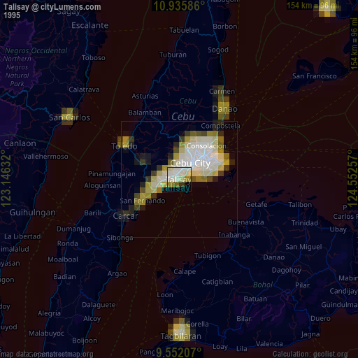
» NASA, Earths city lights 1995
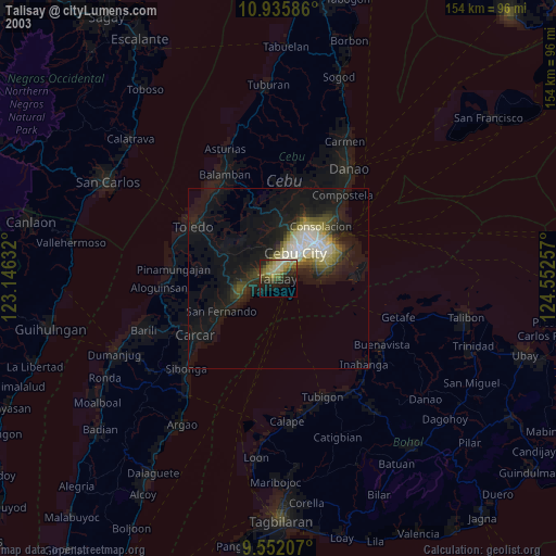
» NASA city lights 2003
» Earth at Night: Flat Maps 2012, 2016