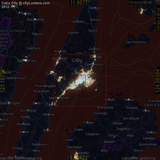
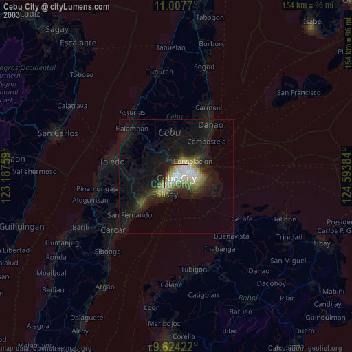
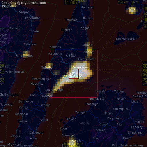
Cebu City night lights from space
Night Light of Cebu City (Central Visayas) from space (Philippines) Src. Average luminocity for 10x10km area is 76.0103% and for 50x50km: 15.3625%.
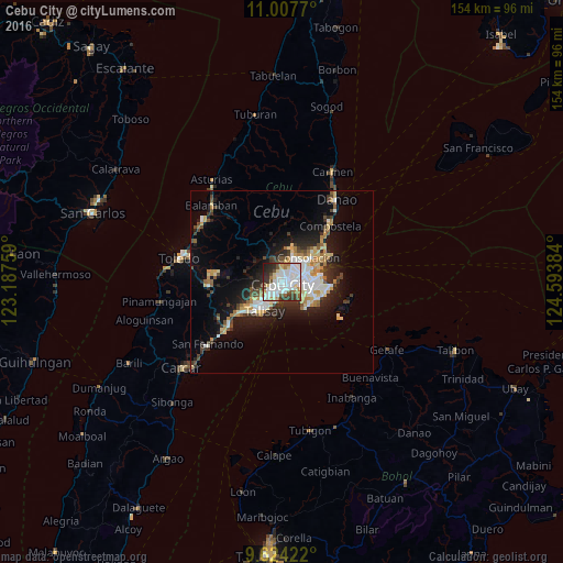
Analysis of Cebu City night lights 2016
Square area 10x10 km:
 29.34%
90-99
24.38%80-89
4.96%70-79
4.13%60-69
6.82%50-59
5.99%40-49
5.99%30-39
8.88%20-29
7.64%10-19
1.86%0-9
0%Square area 50x50 km:
2.92%90-99
2.83%80-89
1.82%70-79
1.6%60-69
2.14%50-59
1.08%40-49
2.1%30-39
2.04%20-29
4.3%10-19
8.19%0-9
70.98%Clear (daylight) street map image can be seen on geolist.org.
Map coordinates:
11° 0' 27.7" North, 123° 11' 15.3" East
10° 19' 0.2" North, 123° 53' 26.6" East
9° 37' 27.2" North, 124° 35' 37.8" East
Some cities around Cebu City sort by population:
• Lapu-Lapu City
6.5 km =4 mi,  96°
96°
• Mandaue City
3.5 km =2.2 mi,  77°
77°
• Talisay
9.2 km =5.7 mi,  209°
209°
• Minglanilla
13 km =8.1 mi,  232°
232°
• Consolacion
9.9 km =6.2 mi,  47°
47°
• Cordova
9.9 km =6.2 mi,  145°
145°
• Apas
3 km =1.9 mi,  25°
25°
• Jaclupan
8.3 km =5.2 mi,  258°
258°
1717512 (p: 798,634)
Sources (retrieved 2019-11-25):
» NASA, Earths city lights 1995
» NASA city lights 2003
» Earth at Night: Flat Maps 2012, 2016