Magalang night lights from space
Night Light of Magalang (Central Luzon) from space (Philippines) Src. Average luminocity for 10x10km area is 15.4979% and for 50x50km: 13.4783%.
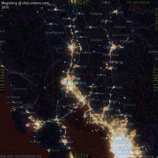

Analysis of Magalang night lights 2016
Square area 10x10 km:
 0%
0%90-99
0%80-89
0.21%70-79
1.03%60-69
3.93%50-59
3.31%40-49
5.99%30-39
4.13%20-29
9.71%10-19
17.56%0-9
54.13%Square area 50x50 km:
0.84%90-99
1.05%80-89
1.16%70-79
3.44%60-69
3.41%50-59
1.36%40-49
2.44%30-39
2.63%20-29
4.37%10-19
8.21%0-9
71.1%Clear (daylight) street map image can be seen on geolist.org.
Map coordinates:
15° 53' 32.9" North, 119° 57' 23.3" East
15° 12' 54.4" North, 120° 39' 34.6" East
14° 32' 7.9" North, 121° 21' 45.8" East
Some cities around Magalang sort by population:
• Angeles City
10.9 km =6.8 mi,  228°
228°
• Santol
11.5 km =7.1 mi,  239°
239°
• Mabalacat City
9.5 km =5.9 mi,  275°
275°
• Pandacaqui
4.8 km =3 mi,  186°
186°
• Telabastagan
12.1 km =7.5 mi,  207°
207°
• San Vicente
8.6 km =5.3 mi,  356°
356°
• Cauayan
7.2 km =4.5 mi,  169°
169°
• Balibago
9 km =5.6 mi, 229°
1704067 (p: 68,988)
Sources (retrieved 2019-11-25):
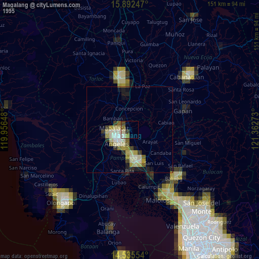
» NASA, Earths city lights 1995
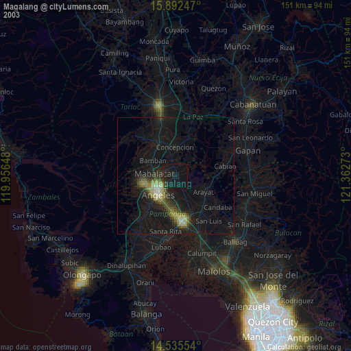
» NASA city lights 2003
» Earth at Night: Flat Maps 2012, 2016