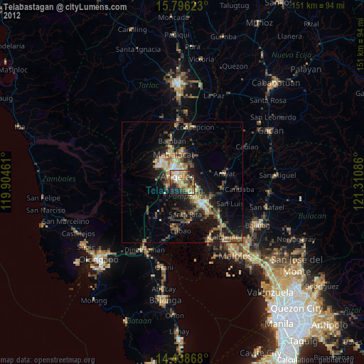
Telabastagan night lights from space
Night Light of Telabastagan (Central Luzon) from space (Philippines) Src. Average luminocity for 10x10km area is 59.9917% and for 50x50km: 15.2182%.
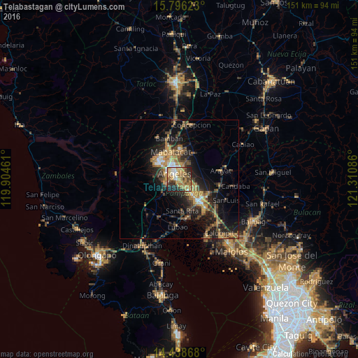
Analysis of Telabastagan night lights 2016
Square area 10x10 km:
 5.17%
5.17%90-99
7.02%80-89
9.09%70-79
19.01%60-69
21.49%50-59
2.48%40-49
10.74%30-39
6.82%20-29
13.22%10-19
4.96%0-9
0%Square area 50x50 km:
0.84%90-99
1.05%80-89
1.21%70-79
3.99%60-69
3.65%50-59
1.63%40-49
3.27%30-39
2.94%20-29
5.21%10-19
10.55%0-9
65.67%Clear (daylight) street map image can be seen on geolist.org.
Map coordinates:
15° 47' 46.4" North, 119° 54' 16.6" East
15° 7' 6.7" North, 120° 36' 27.8" East
14° 26' 19.2" North, 121° 18' 39.1" East
Some cities around Telabastagan sort by population:
• Angeles City
4.4 km =2.7 mi,  323°
323°
• Santol
6.5 km =4 mi, 318°
• Bulaon
7.1 km =4.4 mi,  124°
124°
• Pandacaqui
7.8 km =4.8 mi,  40°
40°
• Manibaug Pasig
5.3 km =3.3 mi,  241°
241°
• Cauayan
7.8 km =4.8 mi,  61°
61°
• Calibutbut
1.1 km =0.7 mi,  248°
248°
• Balibago
5.1 km =3.2 mi,  344°
344°
1682537 (p: 25,935)
Sources (retrieved 2019-11-25):
» Earth at Night: Flat Maps 2012, 2016