Bacolod City night lights from space
Night Light of Bacolod City (Western Visayas) from space (Philippines) Src. Average luminocity for 10x10km area is 57.5372% and for 50x50km: 5.8746%.
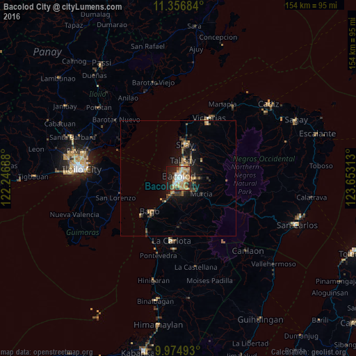
Analysis of Bacolod City night lights 2016
Square area 10x10 km:
 8.88%
8.88%90-99
10.95%80-89
14.26%70-79
11.57%60-69
9.5%50-59
2.27%40-49
6.82%30-39
2.69%20-29
13.02%10-19
18.8%0-9
1.24%Square area 50x50 km:
0.4%90-99
0.52%80-89
0.98%70-79
1.02%60-69
0.98%50-59
0.61%40-49
0.92%30-39
1.09%20-29
1.76%10-19
4.27%0-9
87.46%Clear (daylight) street map image can be seen on geolist.org.
Map coordinates:
11° 21' 24.6" North, 122° 14' 48.8" East
10° 40' 0" North, 122° 57' 0" East
9° 58' 29.7" North, 123° 39' 11.3" East
Some cities around Bacolod City sort by population:
• Mansilingan
5.1 km =3.2 mi,  141°
141°
• Binonga
12.2 km =7.6 mi,  16°
16°
• Talisay
8.1 km =5 mi,  12°
12°
• Taloc
11.8 km =7.3 mi,  210°
210°
• Sumag
8 km =5 mi,  204°
204°
• Murcia
12.1 km =7.5 mi,  124°
124°
• Dos Hermanas
12.7 km =7.9 mi,  48°
48°
• Concepcion
12.4 km =7.7 mi,  76°
76°
1729564 (p: 454,898)
Sources (retrieved 2019-11-25):
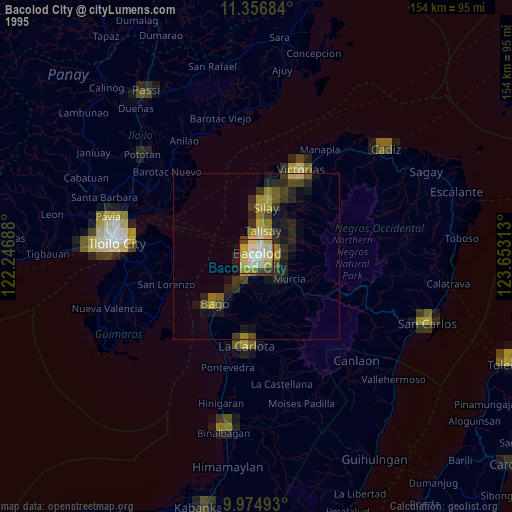
» NASA, Earths city lights 1995
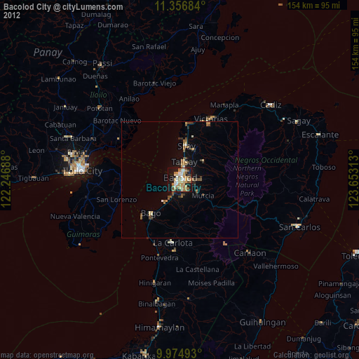
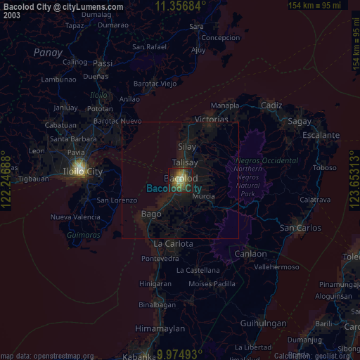
» NASA city lights 2003
» Earth at Night: Flat Maps 2012, 2016